
Time zone CET (UTC+1) Population 275 (1999) | Intercommunality Garazi-Baïgorri Area 5.82 km² | |
 | ||
Canton | ||
Ascarat (Basque: Azkarate) is a French commune in the Pyrénées-Atlantiques department in the Nouvelle-Aquitaine region of south-western France.
Contents
- Map of 64220 Ascarat France
- Geography
- Toponymy
- History
- Administration
- Inter communality
- Demography
- Economy
- Civil heritage
- Religious heritage
- Notable people linked to the commune
- References
Map of 64220 Ascarat, France
The inhabitants are known as Azkaratear.
Geography
Ascarat is located in the former province of Lower Navarre in the Aldudes Valley immediately north-west of Saint-Jean-Pied-de-Port. Access to the commune is by the D918 road from Saint-Jean-Pied-de-Port which passes through the length of the commune on the eastern side and continues to Louhossoa. The D15 road goes north-west from Saint-Jean-Pied-de-Port through the southern part of the commune continuing to Irouléguy. Access to the village is by country roads - Garategana from the D15 and Learraa from the D918. There are substantial forests in the commune however about 70% of the land area is farmland.
The Nive river forms the eastern border of the commune as it flows north to join the Adour at Bayonne. Three streams flow into the Nive in the commune: the Nive d'Arnéguy, the Nive de Béhérobie, the Berroko erreka, and the Pagolako erreka.
Toponymy
The name Ascarat appears in the forms:
Jean-Baptiste Orpustan indicated that the name is composed of aitz ("rock") and garate ("high place"), giving "a height of rocks".
Chubitoa was a hamlet in Ascarat and Anhaux, mentioned in 1863
Jauréguy was a fief, vassal of the Kingdom of Navarre, cited in the 1863 dictionary as was Larragoyen.
The commune name in basque is Azkarate.
History
The parish was mentioned in 1256 and was "ravaged by soldiers" in 1396.
In 1391 Saint-Étienne-de-Baïgorry included the modern communes of Anhaux, Ascarat, Irouléguy, and Lasse.
Administration
List of Successive Mayors
(Not all data is known)
Inter-communality
The commune is part of nine inter-communal structures:
Demography
In 2010 the commune had 312 inhabitants. The evolution of the number of inhabitants is known from the population censuses conducted in the commune since 1793. From the 21st century, a census of communes with fewer than 10,000 inhabitants is held every five years, unlike larger towns that have a sample survey every year.
Sources : Ldh/EHESS/Cassini until 1962, INSEE database from 1968 (population without double counting and municipal population from 2006)
Economy
The commune is part of the production zone of the Appellation d'origine contrôlée (AOC) of Irouléguy and also of the AOC zone of Ossau-iraty.
Economic activity is mainly agricultural.
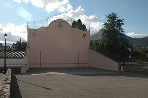
Civil heritage
There are several houses and farms in the commune which are registered as historical monuments. These are:
Religious heritage
The Church of Saint-Julien-d'Antioche is of medieval origin was heavily rebuilt in the 18th and 19th century.