
Palestine grid 174/165 Name meaning "The level place" | ||
 | ||
Weather 7°C, Wind E at 5 km/h, 49% Humidity | ||
as-Sawiya (Arabic: الساويه) is a Palestinian town in the Nablus Governorate in northern West Bank, located 18 kilometers South of Nablus. According to the Palestinian Central Bureau of Statistics (PCBS), the town had a population of 2,301 inhabitants in mid-year 2006.
Contents
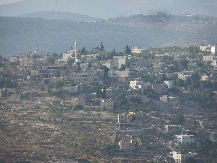
Map of Sawiya
History
At the village site, sherds from IA II (8th and 7th century BCE), the Persian or the early Hellenistic period, Crusader era/ Ayyubid dynasty, Mamluk and early Ottoman era have been found. In the 12th and 13th centuries, during the Crusader era, As-Sawiya was inhabited by Muslims, according to Ḍiyāʼ al-Dīn.
Just north-east of the village is the Khan Sawieh-area, where Byzantine pottery, old tombs and cisterns have been found. Denys Pringle lists the Khan among the Crusader remains in Palestine. In 1838 Robinson found the Khan in ruins, so did de Saulcy in 1850. In the 1882 the Palestine Exploration Fund's Survey of Western Palestine (SWP) described it as: "a small square building, also a ruined Khan; the walls are standing to some height, and drafted stones are used at the corners. Rock-cut tombs exist just south, showing the place to be an ancient site. The name of the site is Khurbet Berkit."
Ottoman era
As-Sawiya was incorporated into the Ottoman Empire in 1517 with all of Palestine, and in 1596 it appeared in the tax registers as being in the Nahiya of Jabal Qubal of the Liwa of Nablus. It had a population of 40 households and 2 bachelors, all Muslim, and paid taxes on wheat, barley, summercrops, olive trees, occasional revenues, goats and beehives.
In 1838 Robinson noted As-Sawiya being situated on a hill. In the 1882 the SWP described Sawiya as "a little village on a hill overhanging the road."
British Mandate era
In a census conducted in 1922 by the British Mandate authorities, As-Sawiya (called: Sawiyeh) had a population of 476, all Muslims, while in the 1931 census it had 128 occupied houses and a population of 596, again all Muslim.
In 1945 Es Sawiya had a population of 820, all Muslims, with 10,293 dunams of land, according to an official land and population survey. Of this, 4,394 dunams were plantations and irrigable land, 3,412 used for cereals, while 40 dunams were built-up land.
1948-1967
In the wake of the 1948 Arab–Israeli War, and after the 1949 Armistice Agreements, As-Sawiya came under Jordanian rule.
post-1967
After the Six-Day War in 1967, As-Sawiya has been under Israeli occupation.
As-Sawiya is entirely dependent on its agricultural land. Prior to the Second Intifada, about 250 of the village's residents worked in Israel, but in 2004 only three continued working there. The primary crops grown in as-Sawiya are wheat, olives, grapes, figs, and beans. The land is also used for grazing livestock. Some residents produce yoghurt from their cows and sell it. Local residents sell olive oil to nearby villages such as Lubban as well. Stone-cutting is the most important industry in the town after agriculture.
According to locals, village life has been "deeply affected" by harassment from Jewish settlers. "People cannot go and harvest their land. The settlers take our olives, they throw rocks at people."