
Time zone EAT (UTC+3) Area 3,236 km² | University Muni University | |
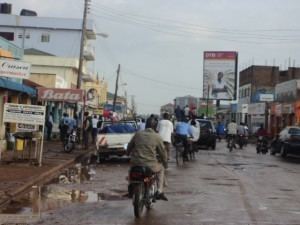 | ||
Arua District is a district in the Northern Region of Uganda. Like many other Ugandan districts, it shares its name with its administrative center of Arua.
Contents
- Map of Arua Uganda
- Location
- Overview
- Population
- Economic activities
- Domesticated livestock and other fauna
- References
Map of Arua, Uganda
Location
Arua District is bordered by Yumbe District to the north, Adjumani District to the northeast, Amuru District to the east, Nebbi District to the southeast, Zombo District to the southwest, the Democratic Republic of the Congo (DRC) to the west, and Maracha District to the northwest. The district headquarters at Arua are located about 425 kilometres (264 mi), by road, northwest of Kampala, the capital and largest city of Uganda. The Coordinates of the district are:03 00N, 31 10E.
Overview
Arua District got its name from Arua town. In the late 1970s, the Ugandan president at the time Godfrey Binaisa declared that all districts/provinces acquire their names from their regional capital so that is how Arua district inherited the name from Arua town. The district originally included Aringa County, which was later split off to become Yumbe District.
The district is the birthplace of former President Idi Amin. Arua District was a springboard for some units of the Uganda People's Defense Force who entered the DRC at the beginning of the Second Congo War.
Arua District is a peaceful district save for the disruption caused in the late 1990s by the Lord's Resistance Army rebels on the Karuma-Pakwach road that provides the main road link into the district. In 2005, the northeastern part of the district was split off as the separate, new district of Koboko District.
Arua District has five counties after three of the original six counties were split off. Koboko was granted district status. Maracha was, in 2006, also granted district status, (Maracha District). Initially, Terego County was also included in Maracha District (Maracha-Terego District). However, failing to agree on were the new district headquarters should be located, Terego County opted to remain part of the larger Arua District. The inhabitants of Terego County in Arua District and those of Maracha District, regard themselves as different ethnicities; although the Government of Uganda recognizes them as the Lugbara. The other counties in Arua District are: Vurra, Madi-Okollo and Ayivu; where the Arua District headquarters are located.
Population
The 1991 national population census estimated the population of the district at about 368,200. In 2002, the national population census gave a population estimate of 559,100, with an annual growth rate of 4 percent. In 2012, the population of Arua District was estimated at 776,700.
Economic activities
Located in a corner of the country that borders both South Sudan and the DRC, a significant amount of local economic activity is the result of cross-border trade. Agriculture is the backbone of Arua District's economy:
Domesticated livestock and other fauna
Due to a high influx of refugees from South Sudan (estimated at 50,000 at one time), the natural environment in the district has been severely stressed, causing deforestation in some areas. The refugee population extensively engages in the growth of Tobacco to raise cash for survival thus putting severe pressure on the land.
In 2008 and 2009, honey is steadily replacing tobacco as a leading income stream, with a ready international market. Piggery is also on the increase in the district. The district produces about 30 tons of fish from over 600 private fish farms and from the River Nile. The district has about 117,000 head of local Zebu cattle. However the district milk output remains low.
The biggest asset of the district is perhaps the continued prevalence of peace and security for the last 25 years and denunciation of rebellion which has attracted many developmental projects. Major achievements include infrastructural transformation such as the tarmacking of the Arua to Karuma Highway, the West Nile Rural Electrification Project and numerous telephone communication networks that have been established in the Region. During 2013, the tarmacking of the Vurra-Arua-Koboko-Oraba Road began.