
Intercommunality Montagne Bourbonnaise Area 26 km² | Canton Lapalisse Population (2013) 372 Local time Thursday 1:46 AM | |
 | ||
Weather 11°C, Wind S at 16 km/h, 71% Humidity | ||
Arronnes (Occitan, Arona) is a French commune in the Allier department in the Auvergne-Rhône-Alpes region of central France.
Contents
- Map of 03250 Arronnes France
- Geography
- Toponymy
- Administration
- Demography
- Distribution of Age Groups
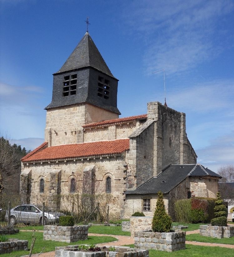
- Sites and monuments
- References
Map of 03250 Arronnes, France
The inhabitants of the commune are known as Arronnais or Arronnaises.
Geography
Arronnes is located some 18 kilometres (11 mi) south-east of Vichy and 6 kilometres (3.7 mi) west by south-west of Le Mayet-de-Montagne. Access to the commune is by the D995 road from Cusset in the north-west passing through the heart of the commune and the village and continuing south-east to Ferrières-sur-Sichon. Apart from the village there are the hamlets of Les Fours, Doyat, Les Barlets, and Les Etangs in the south of the commune. There are substantial forests spread over the commune occupying about 60% of the land area with the balance farmland.
The Sichon river flows from the south-east to the north-west of the commune joined by its tributary the Vareille at the village and continuing north-west to join the Allier in Vichy.
Toponymy
First named in 1282: Arona from the pre-Celtic ar ("stream" or "water") and the Gallic onna meaning river.
Administration
List of Successive Mayors
(Not all data is known)
Demography
In 2013 the commune had 372 inhabitants. The evolution of the number of inhabitants is known from the population censuses conducted in the commune since 1793. From the 21st century, a census of communes with fewer than 10,000 inhabitants is held every five years, unlike larger towns that have a sample survey every year.
Sources : Ldh/EHESS/Cassini until 1962, INSEE database from 1968 (population without double counting and municipal population from 2006)
Distribution of Age Groups
Percentage Distribution of Age Groups in Arronnes and Allier Department in 2010
Sources: