Rahul Sharma (Editor)

Arrochar Alps

Updated on
Edit
Like
Comment
Share on FacebookTweet on TwitterShare on LinkedInShare on Reddit
Peak
  
Beinn Ìme

State/Province
  
Argyll and Bute

Highest point
  
Beinn Ìme

Country
  
Scotland

Elevation
  
1,011 m


Mountains
  
The Cobbler, Beinn Ìme, Ben Lomond, Ben Vorlich - Loch Lom, Beinn Luibhean

Similar
  
The Cobbler, Beinn Narnain, Beinn Ìme, Ben Lomond, Ben Vorlich - Loch Lom

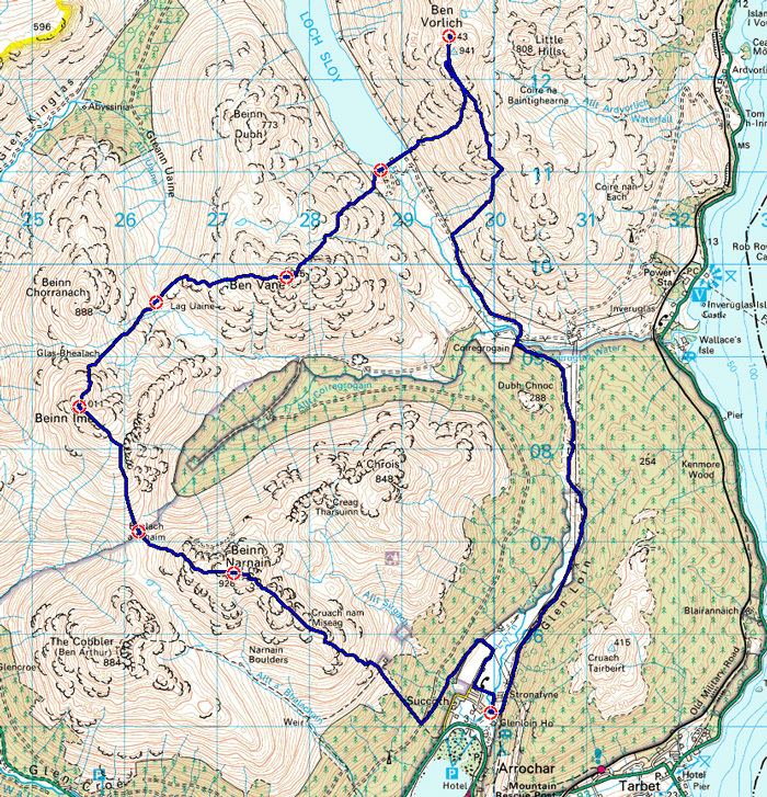
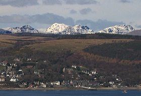
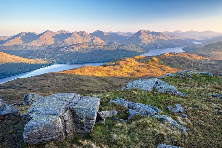
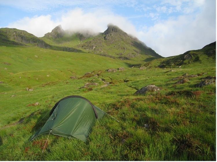
The Arrochar Alps are a group of mountains located around the head of Loch Long, Loch Fyne,and Loch Goil, near the villages of Arrochar and Lochgoilhead, on the Cowal Peninsula in Argyll and Bute, Scotland. The mountains are especially popular with hillwalkers, due to their proximity and accessibility from Glasgow. They are largely within the Loch Lomond and the Trossachs National Park and in part also extend into the Argyll Forest Park. Glens which go into the heart of the range include: Glen Croe, Hell's Glen and Glen Kinglass.

Contents

Arrochar Alps Arrochar Alps Scottish Hill Racing

The list below includes the Munros, Munro Tops, Corbetts, Corbett Tops and Grahams.

  • Munros:
  • Beinn Ìme, 1011m
  • Beinn Bhuidhe, 948m
  • Ben Vorlich, 943m
  • Beinn Narnain, 926m
  • Ben Vane, 915m
  • Munro Tops:
  • Ben Vorlich (North Top}, 931m
  • Corbetts:
  • Beinn an Lochain, 901m
  • The Cobbler (Ben Arthur) 884m
  • Beinn Luibhean, 857m
  • Ben Donich, 847m
  • Binnein an Fhidhleir, 817m
  • The Brack, 787m
  • Beinn Bheula, 779m
  • Corbett Tops:
  • The Cobbler (North Peak, 870m
  • The Cobbler (South Top), 858m
  • A' Chrois, 848m
  • Beinn Chorranach, 848m
  • Little Hills, 808m
  • The Brack (West), 787m
  • Creag Tharsuinn, 781m
  • Ben Vorlich (South Top), 780m
  • Beinn Dubh, 773m
  • Grahams
  • Cnoc Coinnich, 761m (Joint Biggest Graham in Scotland, 1m away from a Corbett)
  • Stob an Eas, 732m
  • Beinn Lochain, 703m
  • Stob na Boine Druim-fhinn, 658m
  • Cruach nam Mult, 611m
  • Other Mountains
  • Mullach Coire a' Chuir, 639m
  • Cruach nan Capull, 565m
  • Cruach Tairbeirt, 1362 ft, 415m
  • Beinn Reithe, 2061 ft
  • The Saddle (Lochgoilhead), 521m
  • Clach Bheinn (Lochgoilhead), 437m
  • Tom Molach, 370m
  • Carn Glas, 502m
  • Tom nan Gamhna, 389m
  • The Steeple (Lochgoilhead), 390m
  • Cruach nam Miseag, 606m

  • Arrochar Alps httpsuploadwikimediaorgwikipediacommonsthu

    Areas of the Arrochar AlpsEdit

    Arrochar Alps Pinterest The world39s catalogue of ideas

  • Tarbet (Eastern Gateway alongside Ardlui and Arrochar)
  • Arrochar (Eastern Gateway alongside Ardlui and Tarbet
  • Ardgartan
  • Rest and be thankful
  • Butterbridge
  • Cairndow
  • Ardno
  • St Catherines
  • Strachur (South Western Gateway)
  • Lochgoilhead (Heart of the range as it sits on the southern range of mountains of Glen Croe
  • Carrick Castle
  • Ardlui (Northern and Eastern Gateway alongside Arrochar and Tarbet
  • Lochs of the Arrochar AlpsEdit

  • Loch Goil (Heart of the range)
  • Loch Restil
  • Loch Long
  • Loch Lomond
  • Loch Sloy
  • Loch Fyne
  • Glens in the Arrochar AlpsEdit

  • Glenbranter (Parly)
  • Hell's Glen
  • Glen Kinglass
  • Glen Croe
  • Glen Loin
  • Tarbet
  • Glen Falloch
  • Glen Fyne
  • Parks in the Arrochar AlpsEdit

  • Loch Lomond and the Trossachs National Park
  • Argyll Forest Park
  • Cowal
  • Ardgoil Peninsula

  • Arrochar Alps On holiday in the Arrochar Alps cairngormwanderer

    References

    Arrochar Alps Wikipedia