
Population 15,560 (2013 Est) Council area Argyll and Bute Country Scotland | OS grid reference NS 09111 85254 Lieutenancy area Argyll and Bute Sovereign state United Kingdom | |
 | ||
World highland dancing champions final fling at cowal highland gathering 2016
Cowal; (Scottish Gaelic: Còmhghall) is a peninsula in Argyll and Bute in the west of Scotland that extends into the Firth of Clyde.
Contents
- World highland dancing champions final fling at cowal highland gathering 2016
- Cowal highland gathering friday live
- Geography and geology
- Cowal Way
- Layout of Cowal
- List of settlements
- Glens of Cowal
- Castles on Cowal
- Church buildings of Cowal
- References
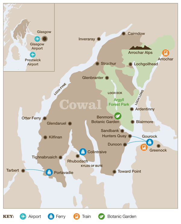
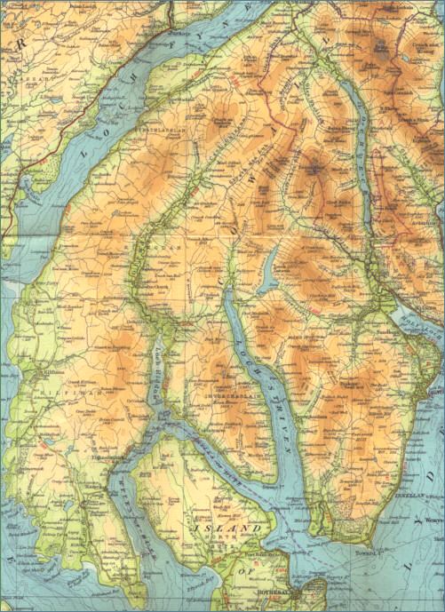
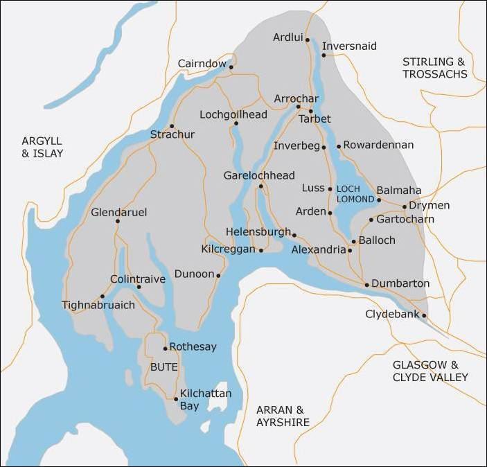
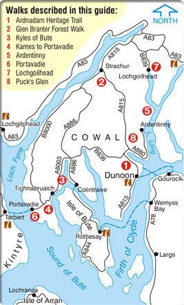
The northern part of the peninsula is covered by the Argyll Forest Park managed by Forestry Commission Scotland. The Arrochar Alps and Ardgoil peninsula in the north fringe the edges of the sea lochs whilst the forest park spreads out across the hillsides and mountain passes, making Cowal one of the remotest areas in the west of Scotland. The Loch Lomond and The Trossachs National Park extends into Cowal. The peninsula is separated from Kintyre by Loch Fyne, and from Inverclyde and North Ayrshire to the east by the Firth of Clyde. Loch Long and its arm, Loch Goil are to the north-east. The south of the peninsula is split into three forks by Loch Striven and Loch Riddon (Loch Ruel). The Isle of Bute lies to the south separated by the narrow Kyles of Bute which connect the Firth of Clyde to Loch Riddon.
Cowal's only burgh is Dunoon in the south-east, from which ferries sail to Gourock in Inverclyde. Other ferries run from Portavadie in the west to Tarbert in Kintyre, and from Colintraive in the south to Rhubodach on the Isle of Bute.
Much of Cowal appears to have been once held by the Lamonts. By the thirteenth century, the Stewarts were the most dominant rulers of the region. Later, the Campbells came to be one of the most powerful families in Cowal.
Cowal highland gathering friday live
Geography and geology
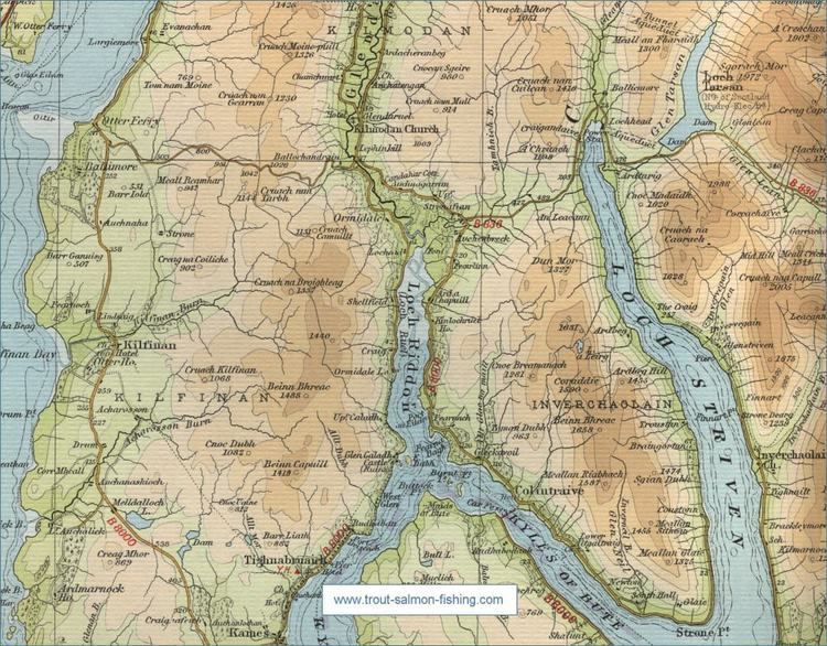
The Cowal peninsula is bounded by Loch Fyne on the west and Loch Long and the Firth of Clyde and Holy Loch on the east. It is separated from the Isle of Bute by the deep narrow straits of the Kyles of Bute. The coastline is incised by deep sea lochs such as Loch Riddon and Loch Striven. Its underlying geology is largely comprised of resistant metamorphic rocks, but south of the Highland Boundary Fault part of the Toward peninsula is comprised sedimentary rocks. The landscape is mountainous, the high ground dominated by moorland, peat mosses and the forest that often extends down the sides of the sea lochs to the water's edge. The acreage of improved farmland is small. Most land is owned by estates or the Forestry Commission Scotland except in the more settled areas.
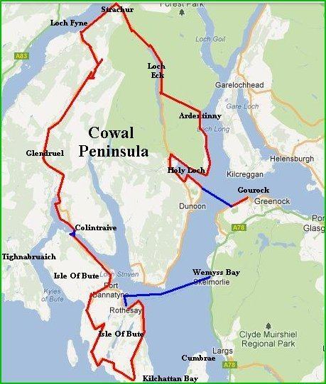
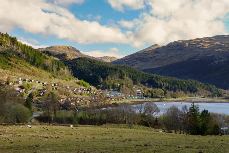
The coast is mostly rocky and the few beaches are mostly shingle and gravel except on Loch Fyne : the longest sandy beach is at Ardentinny on Loch Long. The only lowland areas are around the coast where most of the settlement is found, particularly around Dunoon Cowal's largest settlement on the Firth of Clyde. Other settlements include Innellan, Sandbank, Kilmun, Strone, Arrochar, Lochgoilhead, Tighnabruaich, Kames and Strachur.
Cowal Way
The Cowal Way stretches for over 57 miles through Cowal, from Portavadie on the southeastern shore of Loch Fyne leading to Inveruglas on Loch Lomond, in the Loch Lomond and The Trossachs National Park.
Layout of Cowal
List of settlements
Not a full list.
Glens of Cowal
Not a full list.
Castles on Cowal
Not a full list.
Church buildings of Cowal
Not a full list.