
Intercommunality Pays de Morlaàs Area 4.46 km² | Canton Morlaàs Population (2010) 154 | |
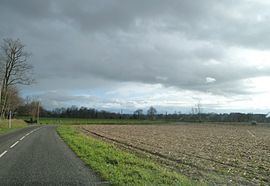 | ||
Arrien (Occitan: Arrien) is a French commune in the Pyrénées-Atlantiques department in the Nouvelle-Aquitaine region of south-western France.
Contents
- Map of Arrien France
- Geography
- Toponymy
- History
- Administration
- Inter communality
- Demography
- Civil Heritage
- Religious Heritage
- References
Map of Arrien, France
Geography
Arrien is located some 18 km east by north-east of Pau and 5 km west of Séron. Access to the commune is by road D42 from Sedzère in the north passing through the heart of the commune east of the village and continuing south to Eslourenties-Daban. The D145 also comes from Baleix in the north and joins the D42 in the commune then continues south-west to Lourenties. Access to the village (Town Hall) is by the Chemin de l'Eglise going west from the D42 and by other local roads. Apart from some patches of forest on the western border the commune is entirely farmland.
The Canne stream forms the southern border of the commune joining the Gabas at the south-western corner which in turn forms most of the western border of the commune flowing north-west then north eventually joining the Adour near Toulouzette. The Poundets stream forms the eastern border of the commune and flows north to join the Petit Lees near Lombia.
Toponymy
Its name in béarnais is Arrien.
Michel Grosclaude indicated that the origin of the name is obscure and mentioned the possibility of the name of a former owner Ariee.
The following table details the origins of the commune name.
Sources:
Origins:
History
Paul Raymond noted that the commune had a Lay Abbey, vassal of the Viscounts of Béarn. In 1385 Arrien had 5 fires and depended on the bailiwick of Pau. The church depended on the Abbey of Saint-Sigismund at Orthez.
The Saint-Jean fountain is known for its healing powers of varicose ulcers and eye diseases and has attracted many pilgrims since the 12th century.
The commune was part of the Archdeaconry of Vic-Bilh, which depended on the Bishop of Lescar. Lembeye was the chief town.
Administration
List of Successive Mayors
(Not all data is known)
Inter-communality
The commune is part of four inter-communal structures:
Demography
In 2010 the commune had 154 inhabitants. The evolution of the number of inhabitants is known from the population censuses conducted in the commune since 1793. From the 21st century, a census of communes with fewer than 10,000 inhabitants is held every five years, unlike larger towns that have a sample survey every year.
Sources : Ldh/EHESS/Cassini until 1962, INSEE database from 1968 (population without double counting and municipal population from 2006)
Civil Heritage
There are two registrations of historical monuments for Arrien:
Religious Heritage
The Parish Church of Saint John the Baptist (19th century) is registered as an historical monument. The church contains several items that are registered as historical objects: