
Country United States Time zone Pacific (UTC-8) Elevation 87 m Local time Wednesday 5:50 AM | Incorporated 1885 ZIP codes 97812, 97861 Population 607 (2013) Area code 541 | |
 | ||
Weather 6°C, Wind SW at 21 km/h, 66% Humidity | ||
How to say or pronounce usa cities arlington oregon
Arlington is a city in Gilliam County, Oregon, United States. The account of how the city received its name varies; one tradition claims it was named after the lawyer Nathan Arlington Cornish, while another tradition claims that the Southern inhabitants of the city had enough clout to rename the city after Arlington, Virginia, home of general Robert E. Lee. The city's population was 586 at the 2010 census.
Contents
- How to say or pronounce usa cities arlington oregon
- Map of Arlington OR 97812 USA
- History
- Geography
- Climate
- 2010 census
- 2000 census
- Economy
- Transportation
- References
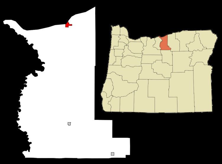
Map of Arlington, OR 97812, USA
History
Originally named Alkali, Arlington came into existence as a place for shipping cattle down the Columbia River. It was incorporated as Arlington by the Oregon Legislative Assembly on November 20, 1885.
Following the completion of the John Day Dam, the original location of Arlington was moved to higher ground in 1963 to avoid the resulting inundation.
Arlington was the birthplace of musician Doc Severinsen, best known as the musical director for the American television program The Tonight Show Starring Johnny Carson (1967–1992).
In 2008, it was discovered that Mayor Carmen Kontur-Gronquist had posted photos of herself in lingerie online, which, along with several other issues, led to her recall from office.
Geography
According to the United States Census Bureau, the city has a total area of 2.4 square miles (6.22 km2), of which, 1.78 square miles (4.61 km2) is land and 0.62 square miles (1.61 km2) is water.
Climate
According to the Köppen Climate Classification system, Arlington has a semi-arid climate, abbreviated "BSk" on climate maps.
2010 census
As of the census of 2010, there were 586 people, 256 households, and 149 families residing in the city. The population density was 329.2 inhabitants per square mile (127.1/km2). There were 315 housing units at an average density of 177.0 per square mile (68.3/km2). The racial makeup of the city was 93.2% White, 0.2% African American, 1.0% Native American, 0.2% Asian, 2.2% Pacific Islander, 2.6% from other races, and 0.7% from two or more races. Hispanic or Latino of any race were 6.7% of the population.
There were 256 households of which 30.1% had children under the age of 18 living with them, 45.7% were married couples living together, 8.2% had a female householder with no husband present, 4.3% had a male householder with no wife present, and 41.8% were non-families. 32.0% of all households were made up of individuals and 8.9% had someone living alone who was 65 years of age or older. The average household size was 2.29 and the average family size was 2.92.
The median age in the city was 43.6 years. 21.8% of residents were under the age of 18; 4.8% were between the ages of 18 and 24; 24.9% were from 25 to 44; 32.9% were from 45 to 64; and 15.5% were 65 years of age or older. The gender makeup of the city was 53.9% male and 46.1% female.
2000 census
As of the census of 2000, there were 524 people, 223 households, and 144 families residing in the city. The population density was 295.2 people per square mile (113.7/km²). There were 277 housing units at an average density of 156.0 per square mile (60.1/km²). The racial makeup of the city was 95.42% White, 1.72% Native American, 1.72% from other races, and 1.15% from two or more races. Hispanic or Latino of any race were 3.24% of the population.
There were 223 households out of which 31.4% had children under the age of 18 living with them, 53.8% were married couples living together, 7.2% had a female householder with no husband present, and 35.4% were non-families. 30.0% of all households were made up of individuals and 8.5% had someone living alone who was 65 years of age or older. The average household size was 2.35 and the average family size was 2.96.
In the city, the population was spread out with 26.5% under the age of 18, 5.9% from 18 to 24, 28.1% from 25 to 44, 25.4% from 45 to 64, and 14.1% who were 65 years of age or older. The median age was 38 years. For every 100 females there were 102.3 males. For every 100 females age 18 and over, there were 93.5 males.
The median income for a household in the city was $35,714, and the median income for a family was $45,875. Males had a median income of $34,250 versus $21,161 for females. The per capita income for the city was $17,883. About 7.9% of families and 10.1% of the population were below the poverty line, including 15.6% of those under age 18 and 9.7% of those age 65 or over.
Economy
Arlington is home to a sizable Waste Management landfill, notably receiving all of Seattle, Washington's trash and some from Portland, Oregon. In March 2010, Waste Management announced their plans to build a waste gasification plant next to their landfill that uses a plasma gasification technology that at the time was considered experimental. The plasma gasification plant was built in conjunction with the company, InEnTec, whose efforts to build such plants in California and elsewhere have met fierce protest. The plant went into pilot operation in November 2011.
The Shepherds Flat Wind Farm and controversies about it emerged in 2009 and 2010, with completion originally scheduled for 2012.
Transportation
According to a 2011 Air Force presentation, Arlington will host a future United States Department of Defense unmanned aerial vehicle base.