
Existed: 1926 – present Length 68.59 km | South end: AR 50 Constructed 1926 | |
 | ||
Counties | ||
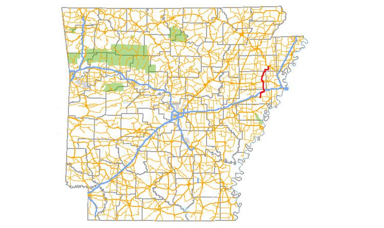
Arkansas Highway 75 (AR 75 and Hwy. 75) is a north–south state highway in Arkansas. The route runs 42.62 miles (68.59 km) from Highway 50 north to Interstate 555/U.S. Route 63/US 63B/AR 14.
Contents
Map of AR-75, Arkansas, USA
Route description
Highway 75 begins at Highway 50 west of Forrest City and runs north to meet U.S. Route 70. The routes form a concurrency as a frontage road to Interstate 40 until exit 256, when AR 75 turns due north and crosses over I-40 at a diamond interchange. Now entering Cross County the route meets Highway 306 at Gieseck. Highway 75 continues north to enter Parkin where the route has junctions with US 64B and its lone spur route before forming a westbound concurrency with US 64. The routes pass Parkin Archaeological State Park and Native American burial mounds before AR 75 breaks north to follow the St. Francis River.
Further north in the county AR 75 has a junction with Highway 42 at Coldwater while continuing to follow the St. Francis River. Highway 75 enters Poinsett County near the Singer Forest Natural Heritage Area. This part of the route is surrounded by sectioned farm land and drainage ditches. Highway 74 terminates at the southern end of Marked Tree, with US 63B/Highway 14 continuing north, I-555/US 63/AR 14 running west and I-555/US 63 running east.
History
Highway 75 was first designated when Arkansas numbered its highways in 1926. The route ran from US 70 in St. Francis County northeast to Turrell. Highway 75 ran concurrent with Highway 16 upon designation. Highway 16 was eventually truncated west of the area (replaced in part by US 64) and Highway 75 changed its routing to a more northly projection. The former alignment to Turrell is now designated Highway 149.
Parkin spur
Arkansas Highway 75 Spur (AR 75S and Hwy. 75S) is a spur route in Parkin. The route is 0.89 miles (1.43 km) in length. Highway 75S serves as the truck route through Parkin, as heavy trucks are not permitted on Highway 75 in town.