
Length 31.35 km | Counties: Crawford | |
 | ||
South end: US 64 east of Van Buren | ||
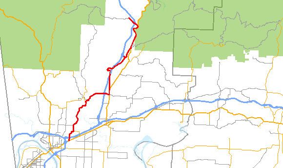
Arkansas Highway 282 is a north–south state highway in Crawford County. The route runs 19.48 miles (31.35 km) north from Van Buren to Chester. The route parallels Interstate 49 for almost its entire length.
Contents
Map of AR-282, Arkansas, USA
Route description
AR 282 begins at US 64 east of Van Buren. The route crosses I-40/I-49/US 71 (no interchange) east of Van Buren before turning north towards Rudy. AR 282 concurs with AR 348 in Rudy before turning east to cross I-49 again. The route continues east to Dean's Market, running north briefly with US 71/AR 162/AR 348. The route continues due north alone, crossing and then crossing back over I-49. AR 282 meets US 71 again in Mountainburg before again crossing I-49 to Chester. In Chester, AR 282 terminates at Brown Street.
Major intersections
The entire route is in Crawford County.
Spur route
Arkansas Highway 282 Spur is a spur route of 0.97 miles (1.56 km) near Mountainburg. The route connects AR 282 over Interstate 49 to the local Arkansas State Highway and Transportation Department shop.