
Existed: 1963 – present Length 9.41 km | Constructed 1963 | |
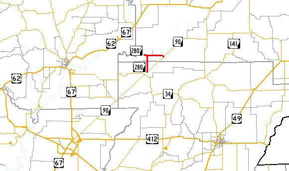 | ||
Arkansas Highway 280 is a state highway in Clay and Greene Counties. The route runs 5.85 miles (9.41 km) from Arkansas Highway 90 near Delaplaine north then east to AR 90 in Peach Orchard. It does not intersect any other state highways.
Contents
Map of State Hwy 280, Peach Orchard, AR 72453, USA
Route description
AR 280 begins at AR 90 and heads due north to Brookings. It then turns and heads due east for 3.0 miles (4.8 km) to Peach Orchard, where it terminates at AR 90. The highway is located near the Dave Donaldson/Black River Wildlife Management Area.
History
The route first became a state highway in 1963. AR 208S/AR 208 from Brookings to AR 90 was paved upon addition to the state highway system.
Brookings spur
Arkansas Highway 280 Spur is a 0.47 miles (0.76 km) spur route to the unincorporated community of Brookings in Clay County.
The entire route is in Brookings, Clay County.