
Existed: 1987 – present Constructed 1987 | Length 44.87 km | |
 | ||
Union pass arizona state route 68 az aerial drone
State Route 68, also known as SR 68, is an east–west highway in northwestern Arizona running from its western terminus at its junction with State Route 95 in Bullhead City to a grade-separated interchange at U.S. Route 93 northwest of Kingman. The western terminus formerly extended just to the west of its current point to Davis Dam; this is now numbered as Mohave County Road 68.
Contents
- Union pass arizona state route 68 az aerial drone
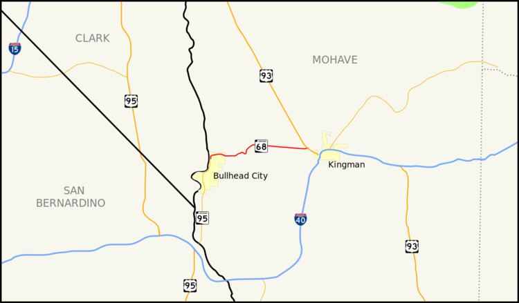
- Map of AZ 68 Arizona USA
- Route description
- History
- Junction list
- References
Map of AZ-68, Arizona, USA
Route description
The primary purpose of this route is to carry traffic to Bullhead City and Laughlin, Nevada. Since September 11, 2001, the highway had also composed part of the mandatory detour for trucks and recreational vehicles traveling between Arizona and Las Vegas, Nevada via US 93, due to the heavy vehicle restrictions over Hoover Dam. The detour was temporary and was removed in 2010, when the new bypass was completed south of the dam .
History
SR 68 was a 2 lane highway and had a high grade going through the Black Mountains. The highway was expanded to 4 lanes in the mid-1990s and now has a smoother ride through the mountains.
Junction list
The entire route is in Mohave County.