
Distribution 89% urban11% rural Median income 42,432 Area 52,367 km² | Population (2015) 713,631 Cook PVI R+1 | |
 | ||
Ethnicity 85.5% White2.2% Black1.7% Asian14.2% Hispanic2.2% Native American0% other | ||
Arizona s 2nd congressional district at a glance
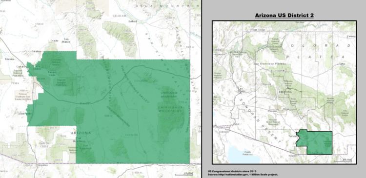
Arizona's 2nd congressional district is a congressional district located in the U.S. state of Arizona. It contains the southeastern corner of the state, including roughly two-thirds of Tucson.
Contents
- Arizona s 2nd congressional district at a glance
- District history
- History and demographics
- Geography
- Main industries
- Schools
- Tourism and recreation
- List of representatives
- Living former Members
- References
After the 2012 census, the bulk of the Maricopa County portion of the old 2nd became the 8th District, while the new 2nd District took in most of the territory of the old 8th district.
One of the characters from House of Cards, Bob Birch, former Speaker of the House of Representatives and the current Minority Leader, is depicted as being a congressman from this district.
District history
From 2003 to 2013, the district contained the northwestern corner of the state and most of the western suburbs of Phoenix as well as a small portion of the city itself. It consisted of all of Peoria (within the exception of the portion of that city within Yavapai County) and Surprise, most of Glendale and much of western Phoenix in Maricopa County, all of Mohave County, and the Hopi Nation in Navajo and Coconino counties. Despite the size and diversity of the district (it included nearly all of the northwestern portion of the state), over 90 percent of its population lived in the strongly conservative western suburbs of Phoenix (known as the West Valley), historically a fairly safe Republican area.
The odd shape of the district was indicative of the use of gerrymandering in its construction. The unusual division was not, however, drawn to favor politicians. Owing to historic tensions between the Hopi and the Navajo Native American tribes and since tribal boundary disputes are a federal matter, it was long believed inappropriate to include both tribes' reservations in the same congressional district. However, the Hopi reservation is completely surrounded by the Navajo reservation. In order to comply with current Arizona redistricting laws, some means of connection was required that avoided including large portions of Navajo land, hence the narrow riverine connection.
George W. Bush carried the district in 2004 with 61% of the vote. John McCain won the district in 2008 with 60.75% of the vote while Barack Obama received 38.07%.
During the Super Tuesday, February 5, 2008 Arizona Democratic Primary, the district was won by Hillary Clinton with 54.52% of the vote while Barack Obama received 35.62% and John Edwards took in 7.43%. In the Arizona Republican Primary, the 2nd District was won by favorite son John McCain with 49.51% while Mitt Romney received 29.51% and Mike Huckabee took in 10.46% of the vote in the district.
In the 2014 midterms, the district was the very last House of Representatives race to be decided, as the official recount began on December 1 due to Republican Martha McSally leading incumbent Democratic congressman Ron Barber by less than 200 votes.
History and demographics
Athabaskan-speaking Native Americans lived in this region long before the arrival of the Europeans who established the Arizona Territory. In the late 19th century, Apache chief Cochise and a band of Chiricahuas built their stronghold on the Dragoon range of mountains. The tribe would often ambush and rob passersby as an attempt to keep interlopers off their land. The presence of the tribe deterred the settlement of the area for far longer than the rest of the Arizona Territory. The district, containing a county now called by his name, developed when its varied and valuable resources were found in the 1870s. The discovery of silver mines in 1878 in the Tombstone district spurred much growth and investment in the area.
Geography
The district is covered by mountains and wide valleys. The district is high desert grasslands with elevations from 3500 to 6000 feet. Several mountain ranges run through the district with the highest peak in the Chiricahua Mountains at 9,796 feet. Southeast Arizona is at an ecological crossroads where habitats and species from the Sierra Madre of Mexico, the Rocky Mountains, and the Sonoran and Chihuahuan deserts can all be found. The abrupt rise of mountains from the surrounding grasslands creates unique habitats harboring rare species and communities of plants and animals. The area has a semi-arid climate with moderate winters and hot summers. Precipitation rarely exceeds one inch in any month other than July, August, and September, when high intensity, but short-lived monsoon storms can occur.
Main industries
Primary job fields of the people in the district include agriculture, ranching, livestock, mining, and tourism. The main irrigated crops are cotton, wheat, corn, grain, sorghum, alfalfa, hay, apples, peaches, cherries, grapes, pistachios, pecans, lettuce, chilis, and other vegetables. The area has a multitude of U-pick vegetable farms and orchards, including several organic farms. Greenhouse tomato and cucumber operations have been completed in the past few years with much success. In Cochise County there is the U.S. Army base Fort Huachuca and numerous military-industrial companies. In suburban and urban areas, Wal-Marts are the most abundant superstores.
Schools
Located within the district is Cochise College, a two-year college. The University of Arizona is within a couple miles of the district border, located in central Tucson. Approximately 2.8% of adults 25 and older have completed less than 9th grade; 5.5% have completed between 9th and 12th grade but have not received a diploma; 17.9% are high school graduates; 26.8% have some college but no degree; 7.5% have an associate degree; 26.1% have a bachelor's degree; and 13.5% have a graduate or professional degree.
Tourism and recreation
Tourism is an important industry as the district has numerous natural wonders, national forests, parks, and conservation areas. There are multiple caverns (including the renowned Kartchner Caverns) and canyons available for visitation. Hiking, camping, fishing, and boating can be found throughout the region. There are also Apache historical sites, war memorials, museums, tour trains, and mine tours. Golfing is popular, and there are multiple golf courses across the district.
List of representatives
Arizona transitioned from electing its members of the House from separate districts with the 1948 elections, after using a general ticket since gaining a second seat in the House with the 1940 Census.
Living former Members
As of April 2015, there are three former members of the U.S. House of Representatives from Arizona's 2nd congressional district that are currently living. The most recent representative to die was Stewart Udall (1955-1961) on March 20, 2010. The most recently serving representative to die was Mo Udall (1961-1991) on December 12, 1998.