
Communes AricaCamarones Area code(s) 56 + 58 | Time zone CLT (UTC-4) Area 8,726 km² University University of Tarapacá | |
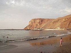 | ||
Points of interest Morro de Arica, St Mark's Cathedral - Arica, Chinchorro Beach, El Laucho Beach, Museum of History and Weapon | ||
Arica Province (Spanish: Provincia de Arica) is one of two provinces of Chile's northernmost and most recently created region, Arica y Parinacota (XV). The province is bordered on the north by the Tacna Province of Peru, on the south by the Tamarugal Province in the Tarapacá Region, on the east the Parinacota Province and on the west by the Pacific Ocean. Its capital is the port city of Arica.
Contents
- Map of Arica Province Arica y Parinacota Region Chile
- History
- Geography and demography
- Administration
- References
Map of Arica Province, Arica y Parinacota Region, Chile
History
On October 8 of 2007, Law 20.175 entered into force, effective on March 23 of 2007. It was signed by President Michelle Bachelet in the city of Arica. At a ceremony held on that morning, the community received in new milestone in its history.
The law divided the former Tarapacá Region into two: the northern portion became the XV Arica y Parinacota Region, and the southern portion remained the I Tarapacá Region.
Geography and demography
According to the 2002 census by the National Statistics Institute (INE), the province spans an area of 8,726.4 km2 (3,369 sq mi) and had a population of 186,488 inhabitants (92,487 men and 94,001 women), giving it a population density of 21.4/km2 (55/sq mi). Between the 1992 and 2002 censuses, the population grew by 9.5% (16,184 persons).
Administration
As a province, Arica is a second-level administrative division of Chile, consisting of two communes (comunas): Arica in the northern portion and Camarones in the south. The coastal city of Arica serves as the provincial capital. The province is administered by a presidentially appointed governor. José Durana Semir was appointed by president Sebastián Piñera.