
Prominence 1,791 m (5,876 ft) Last eruption 1993 Parent range Andes | Listing Ultra Elevation 6,082 m Province Salta Province | |
 | ||
Similar Cerro El Cóndor, Cochiquito Volcanic Group, Caichinque, Huanquihue Group, Cerro del Azufre | ||
Phoenix bird by aracar
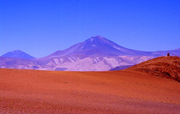
Aracar is a large conical stratovolcano in northwestern Argentina, just east of the Chilean border. It has a main summit crater about 1–1.5 kilometres (0.6–0.9 mi) in diameter which sometimes contains crater lakes, and a secondary crater. The volcano has formed, starting during the Pliocene, on top of a lava platform and an older basement. Constructed on a base with an altitude of 4,100 metres (13,500 ft), it covers a surface area of 192.4 square kilometres (74.3 sq mi) and has a volume of 148 cubic kilometres (36 cu mi). The only observed volcanic activity was a possible steam or ash plume on March 28, 1993 seen from the village of Tolar Grande about 50 km (31 mi) southeast of the volcano, but with no evidence of deformation of the volcano from satellite observations. Inca archeological sites are found on the volcano.
Contents
- Phoenix bird by aracar
- Map of Cerro Aracar Salta Province Argentina
- Aracar alone 20 09 09
- Geology
- References
Map of Cerro Aracar, Salta Province, Argentina
Aracar alone 20 09 09
Geology
Aracar is located in the Salta province, north of the Salar de Taca Taca and Arizaro and east of the Salar de Incahuasi and the Sierra de Taca Taca, close to the Chilean border. Volcanoes in the territory rise above the endorheic sinks and landscape. Cerro Arizaro (9.0 ± 1.3 mya) is another volcano southeast of Aracar.
The basement consists of Paleozoic granites. The Laguna de Aracar Formation north of Aracar was formed by Gondwana volcanism and has been dated by K-Ar methods to be 266±28 mya old, and it is associated with the Llullaillaco Unit. Tertiary sedimentary rocks in the east and arenites in the south form the rest of the basement. The height of the volcano over the surrounding terrain is between 1,900–2,800 m (6,200–9,200 ft) from north to south.
Aracar is a polygenetic volcanic cone with a diametre of 13.5 km (8.4 mi) and a rectangular basis 12–18 km (7.5–11.2 mi), covering a surface area of 192.4 km2 (74.3 sq mi). Four lava domes extend southeast from the volcano. Grey basaltic lava flows descend from its summit and form a gentle western flank and much steeper eastern, northern and southern flanks. West of the main summit a 1–1.5 km (0.62–0.93 mi) wide and several hundred meters deep crater forms Aracar's main crater. Snowmelt occasionally forms small ephemeral lakes in the main crater. A 100 m (330 ft) shallow 10 m (33 ft) deep secondary crater is surmounted by a flat semilunar 15–20 m (49–66 ft) wide surface. Small southbound andesitic lava flows are associated with the main crater. Some deep gorges cut into the volcano, and erosion has removed 1.8 km3 (0.43 cu mi) of rock.
A lava field is found beneath Aracar volcano. It is constructed by lava flows that range in composition from basaltic andesite bordering on trachyandesite over dacite and smaller flows of partially silicic magma. Basal lava flows are heavily eroded and reach 14 km (8.7 mi) of length in the south and width decreasing from 4.5 km (2.8 mi) to 1.5 km (0.93 mi). They have cancelled out the prior landscape. These lower lava flows reach the Salar de Taca Taca and extend south-southeast. The main andesitic cone is 900 m (3,000 ft) high and 5 km (3.1 mi) wide and formed on top of older dacitic lava flows. The dacite flows which form the bulk of the edifice are covered with debris and have flow fronts 20–40 m (66–131 ft) high. The lava field formed over a north-south slope.
Lavas have gray-black porphyric and in some places vesicular textures. Andesine-labradorite plagioclase and pyroxene phenocrysts are found in the lavas, which has a fine grained groundmass. Apatite, augite and opaque mineral inclusions are also found. Some lava flows display very small scale flow bands with feldspat and plagioclase inclusions. Xenoliths containing quartz and gabbro nodules also have part in the rock composition. The overall rock composition is calc-alkaline, similar to other magmas in the Central Volcanic Zone with some intraplate and crustal components, with the magmas forming in an open magma chamber. Later magmas may have been influenced by entry of basic magmas from the depth. The total volume of the edifice is about 148 cubic kilometres (36 cu mi).
The volcanic history of Aracar is poorly understood. The bottom lava flows have ages of 3.4 ± 1.2 to 2.6 ± 0.4 mya. Presumably at first fluid basaltic lavas were erupted. Subsequently dacite lavas were erupted, accompanied with the formation of a strong slope in the edifice and hydrothermal activity at a northwestern lava dome. Finally the central crater and andesite lava flows were erupted. Beneath 4,500 m (14,800 ft) altitude lava flows are well conserved. No historical activity is recorded but March 1993, inhabitants of Tolar Grande 50 km (31 mi) southeast of Aracar observed a high ash or steam column rising from Aracar, which may be either an eruption or the result of landslides. Satellite images did not detect any deformation of the edifice during this episode, probably due to aliasing.
The mountain was first climbed in 1958 by European climbers including Mathias Rebitsch, who found an archeological site in the summit area. Mine fields are present on the northeastern flanks of Aracar, making exploration from that side impossible.
A major Inca archeological site is found on Aracar. Two separate places exist on the summit and the secondary crater. The summit place is formed by a stone circle and low stone walls which are placed just above the slopes down into the main crater. A terrace shaped stone structure forms the secondary crater place, being placed on its slopes. A smaller terrace is located on its northeastern side. Timber and wood are found around the stone structures. All these sites have dimensions of no more than 5 m (16 ft). These structures may be a sanctuary site that could be accessed by a bystanding public during ceremonies, with the sites themselves located within wind protected areas.