
Population ~50 | Length 61 km (37.9 mi) | |
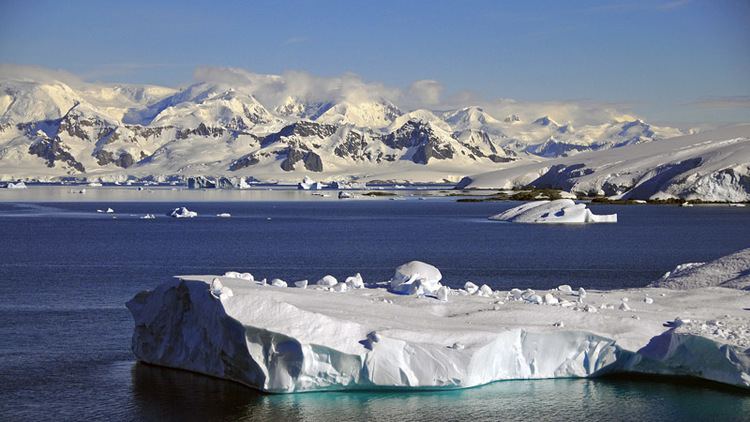 | ||
Anvers Island or Antwerp Island or Antwerpen Island or Isla Amberes is a high, mountainous island 61 km (38 miles) long, the largest in the Palmer Archipelago of Antarctica. It was discovered by John Biscoe in 1832 and named in 1898 by the Belgian Antarctic Expedition under Adrien de Gerlache after the province of Antwerp in Belgium. It lies south-west of Brabant Island at the south-western end of the group. The south-western coastline of the island forms part of the Southwest Anvers Island and Palmer Basin Antarctic Specially Managed Area (ASMA 7). Cormorant Island, an Important Bird Area, lies 1 km off the south coast.
Contents
- Map of Anvers Antarctica
- Palmer Station
- The former station of the British Antarctic Survey
- Ship aground
- DAbnour Bay
- References
Map of Anvers, Antarctica
Palmer Station
The Palmer Station on Anvers Island is located at (64.77°S 64.05°W / -64.77; -64.05) and is Antarctica's only U.S. station north of the Antarctic Circle. Construction finished in 1968. Around 50 people can inhabit Palmer Station at one time. The station is named for Nathaniel B. Palmer, likely to have been one of the first three persons to see Antarctica. There are science labs in the station, as well as a dock.
The former station of the British Antarctic Survey
On Anvers Island, the British Antarctic Survey built and operated a station (Base N) for the purpose of survey and geology. The station of the British Antarctic Survey consisted of a hut and was occupied from February 27, 1955 until January 10, 1958. In 1958, the station of the British Antarctic Survey was closed when local work was completed. The hut of station of the British Antarctic Survey was loaned to the U.S. Government on July 2, 1963, which converted it into a biological laboratory in January 1965 for use by American scientists at the nearby Palmer Station. The station of the British Antarctic Survey was open in support of an air facility from 1969 until 1971. The station of the British Antarctic Survey was destroyed by fire on December 28, 1971 while being renovated by the British Antarctic Survey. Debris was removed by the members of the US Antarctic Program in 1990/1991. Only concrete foundations remain.
A skiway was in use from 1969 to 1973. The air operations were transferred to Adelaide (Station T) in 1973 when the skiway deteriorated. The skiway remained intermittently in use until November 15, 1993.
Ship aground.
On 11 February 1972 the Lindblad Explorer ran aground near La Plaza Point, Antarctica. She was towed to Buenos Aires, Argentina and then to Kristiansand, Norway for repairs.
D'Abnour Bay
D'Abnour Bay is a small bay 3 nautical miles (5.6 km; 3.5 mi) east-southeast of Cape Gronland in northern Anvers Island, Palmer Archipelago. First charted by the French Antarctic Expedition (1903–05) under J.B. Charcot, who named the bay for French naval officer Contre-amiral Richard d'Abnour.