Area 13.27 km² | Arrondissement Tour-du-Pin Intercommunality L'Isle-Crémieu Local time Sunday 2:40 AM | |
 | ||
Weather 1°C, Wind E at 8 km/h, 81% Humidity | ||
Beton imprime annoisin chatelans 38460 france www betonimprimeart fr youtube
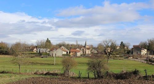
Annoisin-Chatelans is a French commune in the Isère department in the Auvergne-Rhône-Alpes region of southeastern France.
Contents
- Beton imprime annoisin chatelans 38460 france www betonimprimeart fr youtube
- Map of 38460 Annoisin Chatelans France
- Geography
- History
- Administration
- Demography
- Civil heritage
- Religious heritage
- Environmental heritage
- References
Map of 38460 Annoisin-Chatelans, France
The inhabitants of the commune are known as Nuisantins or Nuisantines
Geography
The Village of Annoisin-chatelans is located on the foothills and the plateau of the Isle-Crémieu, some 40 km east of Lyon and just 2 km north-east of the town of Crémieu.
It is part of the Community of communes of l'Isle-Crémieu which includes all the communes around Crémieu, the plain side of Lyon with Chamagnieu and Villemoirieu next to the Optevoz hills area.
The commune is characterized by scattered settlements which comes from the merger of two towns of comparable size, Annoisin which faces Crémieu and Chatelans another two kilometres north which faces on to the valley of Amby (Hières-sur-Amby and Optevoz). There are also two other hamlets south of the village called Michalieu and Le Mollard.
Access to the commune is by the D521 minor road from Crémieu in the south passing though the heart of the commune and the village and continuing north then east to join the D52A to Optevoz. The commune is quite heavily forested in the north and along the eastern and western borders however the southern part of the commune is farmland.
History
The plateau of Larina has been occupied since the beginning of the first millennium. There are still traces on the Larina site north of the commune (an oppidum then a Merovingian camp). The first known text on Annoisin was regarding the Parish and its Church in the 1172-1275 period of the Capetian Kings. Formerly attached to Optevoz, Chatelans was attached to the commune of Annoisin in the early twentieth century.
Administration
List of Successive Mayors
(Not all data is known)
Demography
In 2009 the commune had 623 inhabitants. The evolution of the number of inhabitants is known from the population censuses conducted in the commune since 1793. From the 21st century, a census of communes with fewer than 10,000 inhabitants is held every five years, unlike larger towns that have a sample survey every year.
Sources : Ldh/EHESS/Cassini until 1962, INSEE database from 1968 (population without double counting and municipal population from 2006)
Civil heritage
The commune has a number of buildings and sites that are registered as historical monuments:
Religious heritage
The commune has two religious buildings and sites that are registered as historical monuments:
Environmental heritage
This small village in northern Isère has retained many of its houses made of golden stone extracted from quarries that are still used, its surprising octagonal tower, its communal ovens and lavoirs (Public laundries) hidden in the green meadows. The curiosity of the commune, it is precisely the number of bread ovens and lavoirs whether at Annoisin with one oven; or Chatelans with two ovens, a lavoir, and a fountain in the lower part of the village; or the hamlet of Michalieu with a beautiful collection of a bread oven with a lavoir and its cross.
There are many marked trails that wind through the woods and the blue juniper bushes found in abundance on the limestone plateau. They thrive on the edge of beautiful cliffs overlooking the Rhone valley or on the hills where the top of the Alps and Mont Blanc can be seen.
