
Intercommunality Cœur de Nacre Area 4.19 km² | Region Normandy Canton Creully Population (2009) 666 Local time Saturday 6:49 PM | |
 | ||
Weather 10°C, Wind SW at 18 km/h, 66% Humidity | ||
Anisy is a French commune in the Calvados department in the Normandy region of north-western France.
Contents
- Map of Anisy France
- Geography
- History
- Administration
- Demography
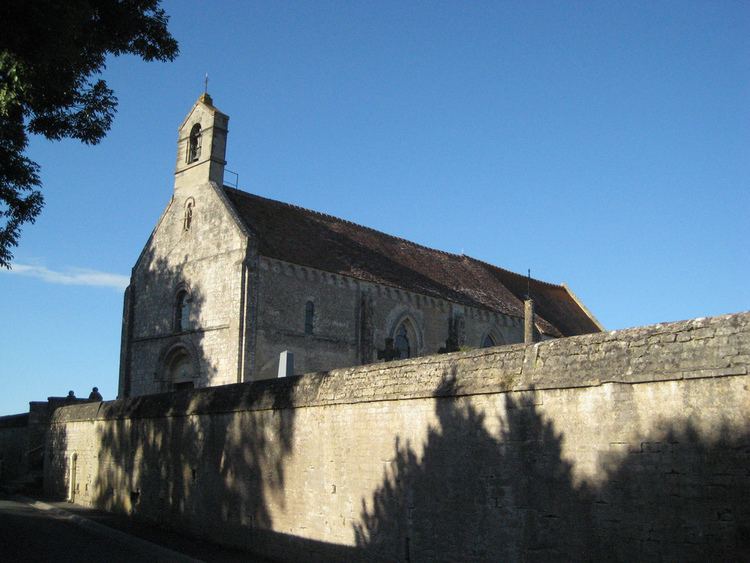
- Sites and monuments
- Notable people linked to the commune
- References
Map of Anisy, France
The inhabitants of the commune are known as Anisiens or Anisiennes
Geography
Anisy is located some 8 km north by north-west of Caen and 4 km south of Douvres-la-Délivrande. It can be accessed by the D79 road from Caen passing through the west of the commune and continuing to Anguerny. The village can be accessed by the D220 road from Mathieu in the east passing through the village and the commune and continuing to Villons-les-Buissons in the south-west. The D220A branches off the D220 in the village and goes south to Cambes-en-Plaine. The D141 from Mathieu to Anguerny also passes through the north-eastern tip of the commune. Apart from the village the commune is entirely farmland.
History
The commune was founded in the 11th century by the Anisy family.
Anisy was liberated by The Queen's Own Rifles of Canada on the first evening of the Normandy landings on 6 June 1944.
Administration
List of Successive Mayors
(Not all data is known)
Demography
In 2009 the commune had 666 inhabitants. The evolution of the number of inhabitants is known from the population censuses conducted in the commune since 1793. From the 21st century, a census of communes with fewer than 10,000 inhabitants is held every five years, unlike larger towns that have a sample survey every year.
Sources : Ldh/EHESS/Cassini until 1962, INSEE database from 1968 (population without double counting and municipal population from 2006)