
 | ||
Similar Menen Hotel, Buada Lagoon, Command Ridge, Moqua Well, Linkbelt Oval | ||
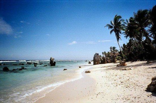
Anibare Bay is a large bay located in the Anibare District of eastern Nauru island.
Contents
Map of Anibare Bay, Nauru
Physical features
It is bordered by capes to the north and south, in Ijuw and Meneng districts respectively.
Its Anibare Beach is in excess of two kilometers long. Anibare Bay was formed by the underwater collapse of the east side of the volcano that underlies Nauru. A large arc shaped blockslid away from the side of Nauru and rotated out. This block extends to about 1100 m below sea level, with rough bulging landslide deposits down to 2000 m below sea level.
Natural ripcurrent hazards
While Anibare Bay is popular with tourists and naturalists, it can be at times dangerous owing to frequent heavy surf and the presence of ripcurrents.
Noted industries
Noted industries include the government-owned Menen Hotel, and Anibare Harbour, an artificial commercial fishing area which was created in 2000.