
Time zone (UTC+12) Area 3.1 km² Area code +674 | Elevation 30 m Population 226 (2011) | |
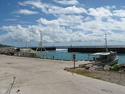 | ||
Anibare is a district in the island nation Nauru, a part of the Anabar Constituency.
Contents
Map of Anibare, Nauru
Geography
It is located in the east of the island, and covers an area of 3.1 km2 (1 sq mi). It has a population of about 250. It is thus Nauru's largest district in area, and among the smallest in population. Nauru's reputation for being densely populated is thus somewhat nuanced, since it refers principally to the average areas and populations of districts other than Anibare.
Local features
References
Anibare District Wikipedia(Text) CC BY-SA