
Population 23 (2001) Civil parish Anglezarke Dialling code 01257 | OS grid reference SD621171 Sovereign state United Kingdom | |
 | ||
Anglezarke reservoir rivington
Anglezarke is a sparsely populated civil parish in the Borough of Chorley in Lancashire, England. It is dominated by reservoirs that were built to supply water to Liverpool, and a large expanse of moorland with evidence of Bronze Age settlements. Popular with walkers and tourists, it lies in the West Pennine Moors in Lancashire, sandwiched between the moors of Withnell and Rivington, and is close to the towns of Chorley, Horwich and Darwen. At the 2001 census it had a population of 23. At the 2011 Census the population is included within Heapey civil parish.
Contents
- Anglezarke reservoir rivington
- Map of Anglezarke UK
- Wild waters of anglezarke
- Toponymy
- Early history
- Manor
- Industry
- Reservoirs
- Second World War
- Governance
- Geography
- Economy
- Landmarks
- Sport and culture
- References
Map of Anglezarke, UK
Quarrying the hard millstone grit for building and paving, mining for lead and minerals, some small-scale coal mining and hill farming were important in Anglezarke particularly from the 17th to the 19th centuries. There is no village: the settlement consisted of scattered farms with the hamlet of White Coppice close to the quarries. The area was subjected to depopulation after the reservoirs were built.
Wild waters of anglezarke
Toponymy
Anglezarke is derived from the Old Norse name Anlaf and the Old Norse erg, a 'hill pasture or shieling'. The elements together mean 'Anlaf's hill pasture'. The earliest spelling of the name was in 1202 when it was recorded as 'Andelevesarewe'. By 1225 this had become 'Anlavesargh', in 1351 'Anlasargh', and by 1559 'Anlazarghe'.
Early history
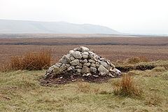
Human activity around Anglezarke can be traced to pre-historic times. Rushey Brow on Anglezarke Moor has a site of special archaeological interest, a working floor from the Mesolithic period, dated to 8th millennium BC. Other sites include Pikestones, a Neolithic burial cairn, and Round Loaf, a Bronze Age tumulus which can be seen from the route across Great Hill from White Coppice.
Manor
Anglezarke was dependent on the barony of Manchester. Albert Grelley gave two oxgangs of land to Robert de Lathom for an annual rent of 3 shillings. In 1339 Edward III granted free warren in Anglezarke to Thomas de Lathum. In 1298 Sir Robert Fitzhenry, Lord of Lathom gifted land as perpetual alms to Burscough Priory who earned income from rents, a confirmation charter was granted by Henry V in 1422. The Knights Hospitallers held land at Anglezarke. In 1406 John of Stanley granted his property in the township held of William of Fulthorp to Edward of Lathom.
Anglezarke became a manor by custom in the 17th century, the manor court was a court baron. Manorial records exist between the years 1654 and 1745 and are held at the Lancashire Records Office.
In 1600 the William Earl of Derby, Edward Rigbye, Thomas Ireland and Michaell Doughtye of Lathom sold the manor to London merchant, Frances Mosseley and Edward Mosseley of Grays Inn for £400.
In the 17th century the Standishes purchased rights to the manor. In 1693 Dame Margaret Standish and her son Sir Thomas petitioned the House of Lords against Hugh Willoughby, 12th Baron Willoughby of Parham for the redemption of a mortgage on the manor and lead mines. In 1721 Sir Thomas Standish leased common land near White and Black Coppice to Sir Henry Hoghton of Hoghton Tower for 21 years. Sir Richard Standish's descendants had inherited an interest in the manor from 1677 until in 1812 when the line came to an end. The extent of the Standish interests is illustrated in a large coloured map produced in 1774 for Sir Frank Standish by George Lang. The manor next passed to a distant cousin, Frank Hall, who assumed the name Standish and died without issue in 1840.
Percival Sumner Mayhew bought the Standish share in 1898 and held rights to shoot game at the common near White and Black Coppice during his lifetime. At the turn of the 20th century Liverpool Corporation acquired a large part of the land to protect the Rivington water supply and many properties were demolished leaving only one or two working farms.
The Manor House, now a Grade II Listed building, was formerly known as High Bullough, from a family of that name. It has a 1604 date stone and other stones inscribed "RS", "W S" and "WL 1778".
Industry
It is possible that lead was mined during the Roman occupation of Britain. A mine was started in 1692 by Sir Richard Standish in partnership with two farmers and a mining engineer and after several failures lead was extracted. In 1694 Richard Standish declared in the Chancery Court that he could not sign over the mines to his wife as he was a tenant. After his death, his widow claimed the profits but lost the resultant court case and flooded the mines by diverting a stream. The operation restarted and was expanded and in 1788-1789, 73 tons of lead were produced. In the 1790s copper and galena were produced. Production ended in 1837 when a lease, granted by Frank Hall Standish in 1824 to the Thompsons of Wigan was relinquished and the unsuccessful enterprise was abandoned. Lead Mines Clough had numerous shafts up to 240 feet deep and on the site was a smelting mill, a smithy and a waterwheel provided power. There are remains of bell pits at Dean Brook and spoil heaps containing traces of barites, calcite and galena. The mines were sealed in 1930 but there has been speculation that the site was part of a secret operation in 1940.
The mineral witherite (barium carbonate) was discovered in spoil from the mines in the 18th century. It was distinct from other sources as it contained above two per cent of carbonate of strontites. Up to this time witherite was considered worthless and used as rat poison by locals. Josiah Wedgwood used it to manufacture Jasper ware and tried to keep the source secret, but after a visit in 1782 by two Frenchmen, a local farmer, James Smithels, exported the mineral to Germany, charging five guineas per ton.
There was a cotton mill at White Coppice owned by Roger Lester at the start of the Industrial Revolution originally powered by a waterwheel and later by a steam engine. Around 1900 the mill was owned by Alfred Ephraim Eccles a supporter of the Temperance movement.
A major contributor to the economy in the 19th century was Lester or Leicester Mill Quarry which supplied hard gritstone flags for paving the streets of the growing industrialised towns. The quarry, named after the millowner in the 18th century, is no longer operational. Millstones were produced at Black Coppice, where some remain.
Coal was mined for local or personal use from drift mines where the coal seam outcropped from Fletcher Bank to Great Hill. The Margery Mine near White Coppice and the Sandbrook Mine in the Yarrow Valley were mined by six men in the 19th century. Drifts were opened up by locals during the 1926 General Strike.
Reservoirs
In 1850 Thomas Pilkington of the Manor House sold land to Chorley Water Company to build High Bullough Reservoir, the first reservoir in the area. Demand for stone increased with the building of the Anglezarke Reservoir, the largest in the Rivington Reservoir Chain in the 1850s. Construction of the Yarrow Reservoir designed by Liverpool's Borough Engineer, Thomas Duncan, began in 1867. It is fed from the River Yarrow and Limestone Brook which have their sources on Anglezarke Moor.
Second World War
The area was used for food production and military training in World War II. Unexploded ordnance was cleared in 1946.
On 16 November 1943, a Wellington Bomber Zulu 8799 crashed into Hurst Hill, just north of Winter Hill, killing all on board. The aircraft was flying from Wymeswold in Leicestershire on a Bullseye exercise. The pilot of the plane was Joseph B. Timperon from Ardrossan, South Australia. Each year on Remembrance Sunday, a service is held at the Wellington Bomber Memorial at Lead Mines Clough, next to Limestone Brook.
Governance
Until the early 19th century, Anglezarke was a township in the ancient parish of Bolton le Moors, itself part of the hundred of Salford in Lancashire. In 1837, Anglezarke joined with other townships (or civil parishes) in the area to form the Chorley Poor Law Union which took responsibility for the administration and funding of the Poor Law in that area. In 1866, Anglezarke became a civil parish. It became part of the Chorley Rural Sanitary District from 1875 to 1894, and then part of the Chorley Rural District from 1894 to 1974. Since 1974, Anglezarke has been a civil parish of the Borough of Chorley.
Anglezarke is part of the Chorley parliamentary constituency, which elected Lindsay Hoyle as Member of Parliament for the Labour party at the 2010 General Election.
Geography
Anglezarke covers 2,793 acres of high moorland on the western slopes of the West Pennine Moors reaching about 1,000 feet above sea level. Anglezarke is a settlement of scattered farmhouses with no village centre. The hamlet of White Coppice where there was a cotton mill is in the north-west corner, and Hempshaws, now in ruins, in the south-east. The township is crossed by a minor road on the western border from Rivington to Heapey. The underlying rocks are millstone grit and sandstones of the lower Lower Coal Measures. There were several quarries whose stone was used for road-making and lead mines. The source of the River Yarrow is at Will Narr on Anglezarke Moor. The west of the area is dominated by the Anglezarke and Yarrow Reservoirs.
Economy
Anglezarke's economy is primarily agricultural, with land used mostly for grazing. Some farmers have diversified into providing leisure and storage facilities for camping, caravanning and guest accommodation. Tourists are attracted by the historic landscape and scenery and access to a network of hiking trails.
Landmarks
In the early 20th century Foggs Buildings, close to Peewet Hall, was vacated. The land was farmed by the Cocker family in the 18th century and by the Pilkingtons in the early 19th century. As properties were abandoned and left to become derelict, the population declined. The remote farms are now landmarks for walkers and geocachers.
The remains of Lower and Higher Hempshaw's, farms inhabited by the Kershaws in the 19th century, are located by a tributary of the River Yarrow which is 300 metres to the southwest. Jepson's Farm and Jepson's Gate are waypoints en route to Pikestones. The last occupants of Old Rachel's were the Evans family in the 1880s. Simms is located on a private track and footpath. The property which got its water from Green Withins Brook, a tributary of the River Yarrow, was occupied by the Chairman of Horwich Urban District Council in 1928-29.
Waterman's Cottage is at the north end of Anglezarke Reservoir. Shorrocks was occupied by Abel Pilkington until his death in 1888; its ruins are by the bridge at White Coppice ponds at the north end of the reservoir.
Sport and culture
Anglezarke Quarry is a destination for rock climbing and has been used for training by serious climbers such as Sir Chris Bonington. Cricket is played at White Coppice. The area was the location for the 2002 Commonwealth Games Mountain Biking competition. There is an extensive network of footpaths providing public access for hikers.
Anglezarke Quarry was used for filming the TV series Jewel in the Crown in 1984. Anglezarke is a setting in the book, "The Spook's Secret" by Joseph Delaney. Musician and poet, Richard Skelton used the Anglezarke landscape to inspire his writing and music.