
Length 29.5 km (18.33 mi) Highest elevation 11 m (36 ft) Elevation 11 m | Width 6.5 km (4.04 mi) Highest point (unnamed) Area 55.95 km² | |
 | ||
Island groups Tuamotu-Gambier Islands, Tuamotus | ||
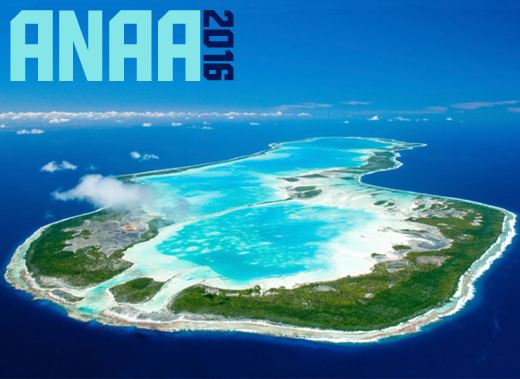
Anaa, Nganaa-nui (or Ara-ura) is an atoll in the Tuamotu archipelago, in French Polynesia. It is located in the north-west of the archipelago, 350 km to the east of Tahiti. It is oval in shape, 29.5 km in length and 6.5 km wide, with a total land area of 38 km² and a population of 500. The atoll is made up by eleven small barren islands with deeper and more fertile soil than other atolls in the Tuamotus. The lagoon is shallow, without entrance, and formed by three main basins. Although it does not have any navigable access, the water of the lagoon renews by several small channels that can be crossed walking.
Contents
Map of Anaa, French Polynesia
History
The atoll of Anaa was known by the legendary cruelty of its soldiers who in the seventeenth century, dominated the north-west of the Tuamotus.
The Spanish expedition of Pedro Fernández de Quirós landed on Anaa on 10 February 1606 and named it Conversión de San Pablo. Its sight was recorded by French explorer Louis Antoine de Bougainville in 1768. James Cook sighted it in 1769. Because of its shape, he called it Chain Island. Later, Anaa was visited by Spanish explorer Domingo de Boenechea, on November 1 of 1772, who called it Isla de Todos los Santos (All Saints Island) because they arrived on All Saints' Day.
At the beginning of the nineteenth century, control of the atoll went to the Pomaré of Tahiti. Around 1850 Anaa was an active center of the nacre commerce and copra, with a maximum population of 2,000. The missionary competition between Mormons of North America and French Catholics led to a revolt in 1852, and an intervention by French colonial troops.
In 1878 and 1906 Anaa suffered severe hurricane damages and was completely flooded. After the hurricane of 1983, the only village was moved and reconstructed, incorporating a refuge shelter with capacity for all its population.
Anaa has a territorial airport which was inaugurated in 1976.
Tukuhora
The main village is Tukuhora, also called Anaa, with a total population of 497 according to the 2012 census. The other small villages like Temarie, Otepipi, Mania and Tematahoa were uninhabited according to the census. The population subsists mainly on fishing, the cultivation of nacre and the production of copra.
Commune of Anaa
Anaa is the capital of the commune (municipality) that also includes the associated atoll of Faaite and the uninhabited atolls of Tahanea and Motutunga.
Faaite
Faaite is an atoll located 60 km to the north of Anaa. The total surface of the atoll is of 230 km². Its dry land area has a surface of 9 km². The inner lagoon has a navigable channel to the ocean. The main village is Hitianau, with a total population of 246. It was discovered by John Turnbull in 1802, the first retailer of the Pacific who used the route of Tahiti to Hawaii. Historically the atoll also has been known as Miloradovich.
Tahanea
Tahanea is an atoll of 63 km², with three passages towards the interior of the lagoon. It is uninhabited and it visited occasionally. It was discovered by Domingo Bonaechea in 1772, who called it San Julian. It has also been known as Tchitschagof.
Motutunga
Motutunga is an uninhabited atoll, with a passage to the interior of the nonnavigable lagoon. Domingo Bonaechea called it San Blas. It has also been known as Adventure Island.