
Country Area 677.7 km2 | Island group Islands of Vanuatu | |
 | ||
Map of Ambrym
Ambrym is a volcanic island in Malampa Province in the archipelago of Vanuatu. Volcanic activity on the island includes lava lakes in two craters near the summit.
Contents
- Map of Ambrym
- Inside olal bungalow north ambrym vanuatu
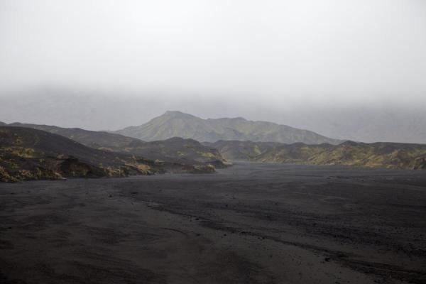
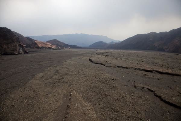
- Ambrym island vanuatu 2016
- Etymology
- Geography
- Volcanology
- Demographics
- Languages
- Nearby small islands to the south
- Southwest
- Southeast
- North
- Tourism
- Transportation
- References
Inside olal bungalow north ambrym vanuatu
Ambrym island vanuatu 2016
Etymology
Ambrym (aka Ambrin) was named by Captain Cook, who anchored off there in 1774.("ham rim" in the Ranon language).
Geography
Located near the center of the long Vanuatuan archipelago, Ambrym is roughly triangular in shape, about 50 km (31 mi) wide. With 677.7 square kilometres (261.7 sq mi) of surface area, it is the fifth largest island in the country.
The summit at the center of the island is dominated by a desert-like caldera, which covers an area of 100 square kilometres (39 sq mi).
With the exception of human settlements, the rest of the island is covered by thick jungle.
Volcanology
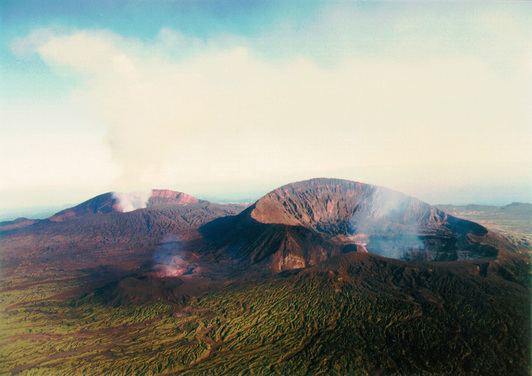
Ambrym is a large basaltic volcano with a 12-km-wide caldera, and one of the most active volcanoes of the New Hebrides volcanic arc.
The caldera is the result of a huge plinian explosion, which took place around 50 AD. Its explosive force is rated 6, the second highest in the Smithsonian Institution's Volcanic Explosivity Index ranks of the largest volcanic explosions in recent geological history.
While at higher elevations cinder cones predominate, the western tip of the island is characterized by a series of basaltic tuff rings, of which the largest is about 1 kilometre (0.62 mi) in diameter. These were produced by phreatic eruptions when magma contacted the water table and water-saturated sediments along the coast.
The massive, 1900-year-old, 12 kilometres (7.5 mi) × 8 kilometres (5.0 mi) caldera is the site of two active volcanic cones, Benbow and Marum (also spelled Maroum).
Mount Benbow was named by Captain Cook after English Admiral John Benbow (1653–1702), whom Cook admired.
Several times a century, Ambrym volcano has destructive eruptions. Mount Benbow last erupted in 1913, causing the evacuation of the population to Mele, near Port Vila on Efate.
Volcanic gas emissions from this volcano are measured by a Multi-Component Gas Analyzer System, which detects pre-eruptive degassing of rising magmas, improving prediction of volcanic activity.
In March 2017, Google added the Marum crater with its lava lakes to Google Streetview.
Demographics
With the neighbor island of Malakula and a few smaller islands, Ambrym forms Malampa Province. The population of 7,275 inhabitants lives mainly off coconut plantations in the three corners of the island.
Languages
Like many islands in Vanuatu, Ambrym has its own Austronesian languages. In the north is the North Ambrym language, in the southeast is the Southeast Ambrym language, in the south Daakaka language, in the west Lonwolwol language, and in the southwest Port Vato language. These are all spoken by a few hundred to a few thousand speakers each.
The kinship system used by natives of Ambrym can be modeled by a non-commutative group.
Nearby small islands to the south
Southwest
Southeast
North
Tourism
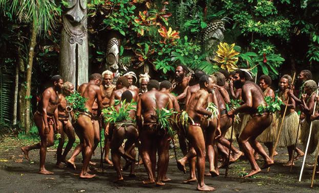
Tourists are attracted by Ambrym's unique features: the active volcanoes, the tropical vegetation, and the customs of the local villagers. They stay in traditional bungalows, as there are no hotels on the island.
Transportation
The island is served by two airports, Ulei Airport in the southeast and Craig Cove Airport in the southwest.