
 | ||
Vanuatu tourism in malampa province
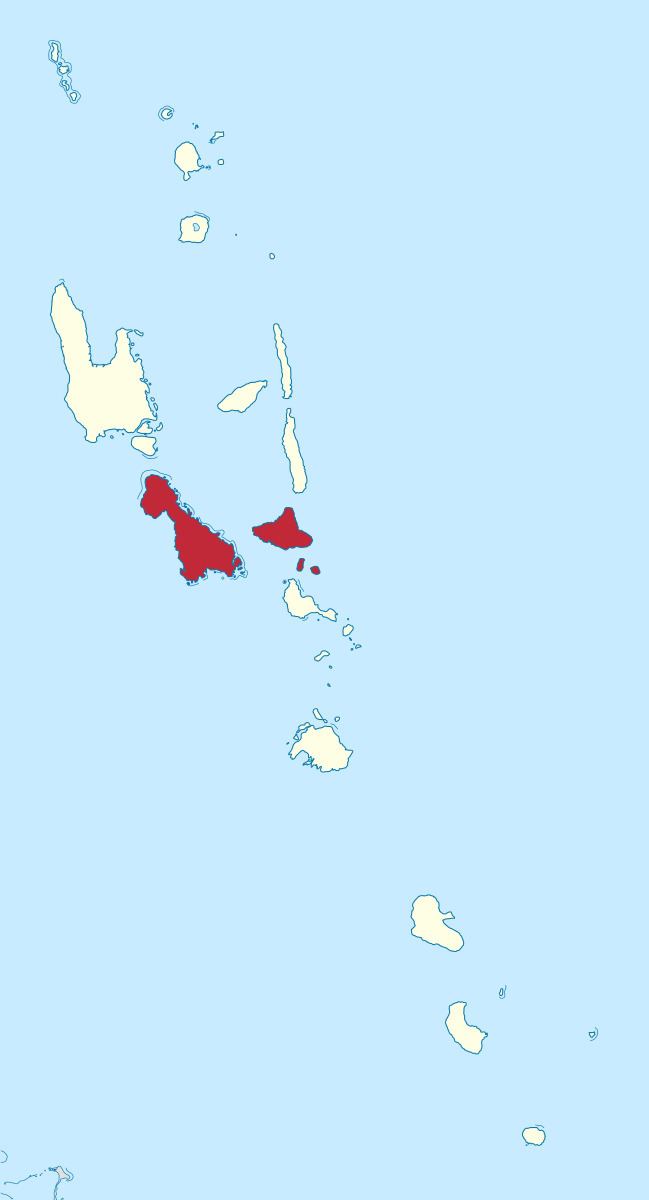
Malampa is one of the six provinces of Vanuatu, located in the center of the country and consisting of three main islands:
Contents
Map of Malampa Province, Vanuatu
It includes a number of other islands – the small islands of Uripiv, Norsup, Rano, Wala, Atchin and Vao off the coast of Malakula, and the volcanic island of Lopevi (currently uninhabited). Also included are the Maskelynes Islands and some more small islands along the southcoast of Malakula.
The province's name is derived from the initial letters of MALakula, AMbrym, PAama.
Population
It has a population of 36,722 (2009 census) people and an area of 2,779 km². Its capital is Lakatoro on Malakula.
Mountains
Bays
References
Malampa Province Wikipedia(Text) CC BY-SA