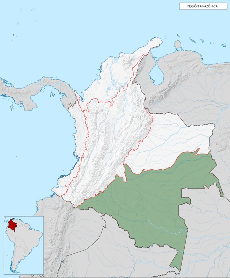
Amazonía region in southern Colombia comprises the departments of Amazonas, Caquetá, Guainía, Guaviare, Putumayo and Vaupés, and covers an area of 403,000 km², 35% of Colombia's total territory. The region is mostly covered by tropical rainforest, or jungle, which is a part of the massive Amazon rainforest.
The region is bounded by the East Andes along the western edge and extends to the Venezuelan and Brazilian borders in the east. The northern limit begins with the Guaviare and Vichada Rivers and extends south to the Putumayo and Amazon Rivers.
The Amazon region is divided up into distinct subregions:
Amazon foothills: bordering the East AndesCaquetá River Plain: the main watershed of this regionInírida River Plain: location of the famous Cerros de MavecureGuaviare River Plain: shared with the Eastern PlainsPutumayo River Plain: along the southern borderSerranía de ChiribiqueteAmazon Trapezium: the area of land that actually borders with the Amazon RiverOther important rivers include the Vaupés, Apaporis and Yarí.
The tropical rainforest classified more specifically as a tropical moist broadleaf forest. Within the Colombian Amazon region there are five moist forest ecoregions:
Caquetá moist forest: the largest part of the Colombian Amazon region centered on the Caquetá, Vaupés, Yarí, and Apaporis RiversNapo moist forest: the southwest corner of the Colombian Amazon region which borders the Andes and includes the headwaters of the Caquetá and Putumayo RiversSolimões-Japurá moist forest: in Colombia this ecoregion is centered on the Putumayo and Amazon RiversJapurá-Solimões-Negro moist forest: this ecoregion barely extends into Colombia mainly around the Lower Vaupés and Negro RiversCampinarana: this ecoregion of white sandy forest and swamps barely extends into Colombia around the Negro River in the Department of VaupésPNN Alto Fragua Indi-WasiPNN AmacayacuPNN CahuinaríPNN Serranía de ChiribiqueteRNN NukakPNN La PayaRNN PuinawaiPNN ío PuréPNN Serranía de los Churumbelos Auka-WasiPNN TiniguaPNN Yaigojé Apaporis