Neha Patil (Editor)

Amantea

Updated on
Edit
Like
Comment
Share on FacebookTweet on TwitterShare on LinkedInShare on Reddit
Country
  
Italy

Province / Metropolitan city
  
Cosenza (CS)

Demonym(s)
  
Amanteani

Province
  
Province of Cosenza

Postal code
  
87032

Region
  
Calabria

Elevation
  
50 m (160 ft)

Area
  
28 km²

Local time
  
Monday 4:09 PM

Amantea wwwitalyheavencoukcalabriaimagesamantea5jpg

Frazioni
  
Acquicella, Camoli, Campora San Giovanni, Coreca, Colongi

Weather
  
18°C, Wind E at 13 km/h, 66% Humidity

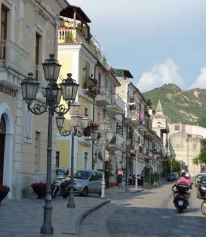
Amantea (Greek: Amanthea) is a town and comune in the province of Cosenza in the Calabria region of southern Italy.

Contents

Map of 87032 Amantea Province of Cosenza, Italy

It is a tourist centre on the southern Tyrrhenian Sea coast.

History

Amantea appears as a centre of its own in the 7th century, although traces of human presence from pre-historical times onwards have been found in the area. In 839 the Arabs captured it, being ousted by the Byzantines in 889. Later it was under Norman domination. In 1269 the Amanteani rebelled against the Angevines in the name of Conradin of Hohenstaufen, but were besieged by the French and defeated.

The town is mostly famous for the long resistance of its inhabitants against the French troops under Joseph Bonaparte who, in 1806–1807, attempted to conquer its castle.

In July 1810, three British warships, the frigate HMS Thames, HMS Weazel, and Pilot, captured or destroyed a convoy of 31 coasting vessels that were carrying stores and provisions from Naples to Murat's army at Scylla. Seven large gunboats, four scampavias, and an armed pinnace protected the convoy. At the approach of the British warships the convoy and its escorts beached themselves in front of Amantea, but the British were still able to capture almost all the vessels, and destroy half a dozen, all while suffering only minimal casualties.

Main sights

  • The Rocca (Castle). First built by the Byzantines, it was strengthened by the Arabs. The current cylindrical tower is however to the Norman-Hohenstaufen age. It was long besieged by Charles of Anjou's troops in 1269. It was nearly destroyed during the French siege in 1806-1807. It is now a public structure, but is abandoned.
  • Church of San Bernardino.
  • Palazzo delle Clarisse (17th century). The palace was built in the early seventeenth century as the Convent of the Poor Claires (Clarisse) and has remained a convent until 1806 when the French, as a result of the siege of Amantea, confiscated it along with other church properties and then sold it to the Marquis de Luca di Lizzano who made it his noble residence. The Marquis De Luca lived in the palace until 1977. Following a period of severe neglect and decay, the building was then purchased and restored by the current owner, Prof. Fausto Perri. The Palazzo delle Clarisse now hosts cultural and commercial activities such as concerts, exhibitions and paintings by the masters of the Atelier of Copyists, a highly specialized Italian laboratory with great tradition as well as a restaurant with a beautiful view of the sea.
  • Palazzo Mirabelli (17th century).
  • U Turriune (large tower, 14th century) at Campora San Giovanni.
  • Archaeological findings in the area of Campora San Giovanni.
  • Capuchins Church.
  • References

    Amantea Wikipedia