
Country France Intercommunality Confolentais Area 46.54 km² | Population (2014) 492 Local time Sunday 3:56 PM | |
 | ||
Weather 11°C, Wind S at 18 km/h, 82% Humidity | ||
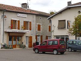
Plazza d alloue parcour cso
Alloue is a French commune in the Charente department in the Nouvelle-Aquitaine region of southwestern France.
Contents
- Plazza d alloue parcour cso
- Map of 16490 Alloue France
- Concours au man ge de l alloue en 60 cm avec mimi de lize
- Location and access
- Hamlets and localities
- Geology
- Relief
- Hydrography
- Dialects
- Climate
- Toponymy
- History
- Administration
- Demography
- Distribution of Age Groups
- Economy
- Education
- Other services
- Civil heritage
- Religious Heritage
- Notable People linked to the commune
- References
Map of 16490 Alloue, France
Alloue was part of the province of Limousin and they speak the Occitan form of the Limousin dialect.
The inhabitants of the commune are known as Allousiens or Allousiennes
Concours au man ge de l alloue en 60 cm avec mimi de lize
Location and access
Alloue is a commune located in the north-east of the Charente at the edge of the Charente Limousine and Ruffécois regions, 5 km south of the boundary of the department of Vienne. It belongs to the Community of communes of Confolentais.
The commune is 9 km east of Champagne-Mouton, capital of the canton, and 12 km west of Confolens. The main road that runs through the village and the commune from east to west is the D740, the former national road from Confolens in Niort via Ruffec (24 km) and via Champagne-Mouton. Angoulême is 50 km to the south-west and Limoges a similar distance to the south-east. Alloue is also 15 km north of Saint-Claud and Roumazières-Loubert.
Other minor departmental minor roads run through the commune including the D169 south to Roumazières-Loubert via Ambernac,the D171 towards Benest in the west, the D312 heading north-west, the D169 north to Épenède and Pressac, the D309 to Ansac-sur-Vienne in the south-east, and the D313 heading towards Manot in the south-east.
Hamlets and localities
The commune has many small hamlets:
Chez Pasquet borders the town to the north as does La Cantine to the south of the town on the left bank of the river.
Geology
The land is composed of marl limestone dating from the Early Jurassic period in the valley and deposits of Clay from the Tertiary period on the slopes.
The old Galena (lead and silver) mine at Beaumont was composed of veins on a fault which follows the valley of the Charente to Ambernac until it nearly reaches Asnois (Vienne) and passes through Alloue. The mine consists of tunnels dug into the rock.
Relief
The relief of the commune is that of a plateau with an average altitude of 180 m, traversed from south to north by the valley of the Charente. The highest point is at an altitude of 231 m which is located in the Bois de Signes (Signes Forest) on the eastern edge of the commune. The lowest point is 136 m which is located along the Charente on the north-western boundary. The village is in the valley and on the right bank of the river and is 145 m above sea level.
Hydrography
The Charente flows through the commune from south to north. The part in the commune is downstream of Roumazières and upstream of the Vienne department where the river makes an incursion before returning to Ruffec and Angoulême.
The Transon, a tributary on the right side of the Charente joining at Chatain (Vienne), rises in the south-east of the commune and along its eastern boundary.
The Charente has many small tributary streams rising in the commune such as the Ruisseau de la Forêt (Forest Stream) which flows in the northwest.
The Clain, a tributary of the Vienne passing Poitiers, rises in the commune of Hiesse 50 m from the communal boundary at Beau Clain. The watershed line between the basins of the Charente and the Loire crosses the eastern edge of the commune.
The commune of Alloue also has many ponds and small water reservoirs, mainly in the south-west.
Dialects
The town is in the Occitan area of Marchois in contact with the Limousin dialect and marks the boundary with the Poitevin langue d'oil (to the northwest)
Climate
As for a large part of the west of the department, the climate is an Aquitaine Oceanic climate but it is slightly degraded near the Charente Limousine area where the climate is more humid and slightly cooler.
Toponymy
The name of the commune Alloue is said to come from the Gallic word alauda meaning lark.
The hamlet of Beaumont comes from the French beau mont which means "beautiful hill".
Les Essarts was designated in the Middle Ages to be cleared of forest.
The hamlet of Fontbeau may take its name from the Latin fons or fontis meaning "source" and bellus meaning "handsome". It can therefore mean "beautiful spring" but it is more likely from the Occitan font bou (fons bovis in Latin) to the French fontaine de boeuf (fountain of beef).
For the hamlet of Masmayoux the origin is from the Latin major meaning "bigger" and mansus which had become mas by the Middle Ages and which designated an agricultural field. It can therefore lead to the meaning "large farm".
Les Repaires comes from the old French repair meaning house or fortified castle.
History
Tools, particularly polished axes, and a tumulus have been found in Caillauds which attests to the antiquity of occupation of the area.
The old silver-lead mine in the commune has been worked since the Gallic era.
A Roman road passed by Alloue and its remains are visible at a place called les Repaires
Alloue formed part of the province of Poitou as with most towns west of Confolentais and the Occitan language Limousin dialect was widely spoken under the Ancien Régime.
In 783 the name Alloue was mentioned when Roger, Count of Limoges gave land at Alloue for the creation of the Charroux Abbey. On 23 April 1121, Guillaume I, Bishop of Poitiers, donated the Alloue Church to the Abbey of Charroux. This Benedictine priory which had prior rights of low, medium and high justice was plundered in 1356 and then restored. In the 16th century the priory had four occupants and the prior. From a survey in 1547, the Priory of Alloue had twenty houses in the village and about 125 tenements in the parish and neighbouring parishes. On a 1740 plan they were shown next to the church with farm buildings and gardens. The priory closed in 1781. It was sold as national property during the Revolution.
There were four fiefs and castles on the territory:
The Fief of Geuche was mentioned in 1396, when it belonged to Perrenot La Lande. In the 17th century it was the property of the Gracieux family and was sold as national property during the Revolution.
The manoir de l'Age for which in 1399 Guy de l'Aage Landri, squire, made an admission to Aimar, the Abbot of Charroux that his "accommodation of l'Age de Volude in Alloue" . The word volude means a small valley and the word age a fortified enclosure. The Manoir de l'Age was successively occupied by the families Green de Marsault, L'Aage, and Verdilhac.
The Castle of Massignac in the 15th century belonged to the Tizon family then in the 16th century to the Barbarin family, passing to the Regnaud family, and finally by marriage to the Guiot family before being sold as national property during the Revolution.
A mill that existed in the north was destroyed.
The lordship of La Vergne had the rank of Châtelainie.
Administration
When the town was founded in 1793 it was named Allouë and it was the capital of the canton. In 1801, still with the same name, it belonged to the canton of Champagne-Mouton and it was only later that it became Alloue.
List of Successive Mayors of Alloue
(Not all data is known)
Demography
In 2009 the commune had 527 inhabitants. The evolution of the number of inhabitants is known through the population censuses conducted in the town since 1793. From the 21st century, a census of municipalities with fewer than 10,000 inhabitants is held every five years, unlike larger towns that have a sample survey every year.
Sources : Ldh/EHESS/Cassini until 1962, INSEE database from 1968 (population without double counting and municipal population from 2006)
Distribution of Age Groups
Percentage Distribution of Age Groups in Alloue and Charente Department in 2007
Sources:
With 1720 people at its inception, the commune has been the victim of a slow erosion that accelerated during the 20th century and has lost 70% of its population in two centuries.
Economy
The lead mine was worked since the Gallic era until after the abbot Michon. It was operated by a Sir Villain in the 18th century and in 1818, according to Quenot, there were a dozen open pits. Then the mine was operated by several concessionaires without much success due to the poor quality of the ore and the difficulty of separating the galena from the several intertwined minerals. A company was founded in 1821 then abandoned the mine in 1829, recovered, then abandoned it again and, after a last attempt in 1930, it was finally closed due to insufficient profitability.
In the 19th century four mills were in operation. *one, a wheat mill, became an oil and dairy factory then the Charente was diverted.
Currently activity in the commune is mainly agricultural.
Shops include a baker, a restaurant and an agricultural parts merchant.
There are also a hairdresser, a bricklayer, an electrician/plumber/heating merchant, a bicycle repair shop and a landscaper.
Education
The school is a regroupment school covering Alloue, Ambernac, and Benest. Alloue has a primary school (both kindergarten and elementary); Benest and Ambernac have an elementary school.
Other services
There is a post office and there are other services in the surrounding communities, mainly Confolens.
Civil heritage
There are in excess of 200 sites in the commune that are registered as historical monuments with the majority of sites Houses or Farmhouses. For a complete list of historical sites in the commune together with links to descriptions (in French) and photos click here. A selection of the more interesting sites are described below.
There are also old Lavoirs at Masmayoux where the well is an uncovered rectangular basin fed by a spring that emerges from a cube of masonry and stone rubble and near Lasfond which also has an uncovered basin.
Religious Heritage
The Parish Church of Notre-Dame (12th century) is registered as an historical monument. The church contains two items that are registered as historical objects:
The church included both a parish church and a Benedictine priory (12th century) founded by the monks of Charroux in the 8th century that stretched south and west of the church. The Priory of Alloue on the 1740 plan is presented as a set of buildings surrounded by a moat which joined the Charente. Currently the western part still remains – rebuilt in the 16th and 17th centuries. The lodgings of the prior was in line with the north wall of the church, preceded by a courtyard overlooking the street between the two towers. Another house has since been built on the site of the courtyard.
There is a Cemetery Cross (1789) bearing the inscription "PIORRY NOTARY ET FABRIC/QUEUR 1789". This stone cross in a cylindrical drum is raised on a plinth consisting of four steps. In front, a stone font is located on a stone slab.