
Time zone CET (UTC+1) Area 23.6 km² Dialling code 0473 | Dialing code 0473 Local time Saturday 10:22 AM Postal code 39022 | |
 | ||
Frazioni Aschbach (Riolagundo), Forst (Foresta), Mitterplars (Plars di Mezzo), Mühlbach (Riomolino), Oberplars (Plars di Sopra) and Vellau (Velloi) Weather 7°C, Wind NW at 8 km/h, 49% Humidity Region Trentino-Alto Adige/South Tyrol | ||
S dtirol 2013 nostalgie in algund vellau
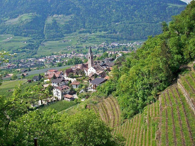
Algund ( [alˈgʊnt]; Italian: Lagundo [laˈɡundo]) is a comune (municipality) in South Tyrol in northern Italy, located about 25 kilometres (16 mi) northwest of Bolzano.
Contents
- S dtirol 2013 nostalgie in algund vellau
- Map of 39022 Lagundo Province of Bolzano South Tyrol Italy
- Algund bei meran mediterran alpiner urlaubsort in s dtirol
- Geography
- Frazioni
- Place name
- Coat of arms
- Linguistic distribution
- Demographic evolution
- References
Map of 39022 Lagundo Province of Bolzano - South Tyrol, Italy
Algund bei meran mediterran alpiner urlaubsort in s dtirol
Geography
As of 30 November 2010, it had a population of 4,837 and an area of 23.6 square kilometres (9.1 sq mi).
Algund borders the following municipalities: Lana, Marling, Merano, Naturns, Partschins, Plaus and Tirol.
Frazioni
The municipality of Algund contains the frazioni (subdivisions, mainly villages and hamlets) Aschbach (Riolagundo), Forst (Foresta), Mitterplars (Plars di Mezzo), Mühlbach (Riomolino), Oberplars (Plars di Sopra) and Vellau (Velloi).
Place name
The name apud Algunde (Latin for close to Algund) appears for the first time in 994.
Coat-of-arms
The emblem is a barrel of wine, overhanged by a vine-shoot of black grapes, on or bordered by an argent and gules crown gear. The barrel and grapes symbolize the viticulture practiced in the area, the argent and gules indented frame represents the membership to the Tyrol. The emblem was adopted in 1970.
Linguistic distribution
According to the 2011 census, 85.17% of the population speak German, 14.58% Italian and 0.25% Ladin as first language.