
Elevation 310 m (1,020 ft) Postal code 39011 | Time zone CET (UTC+1) Population 11,120 (2009) | |
 | ||
Frazioni Völlan (Foiana), Pawigl (Pavicolo), Ackpfeif (Acquaviva) Weather 4°C, Wind NW at 10 km/h, 54% Humidity Region Trentino-Alto Adige/South Tyrol | ||
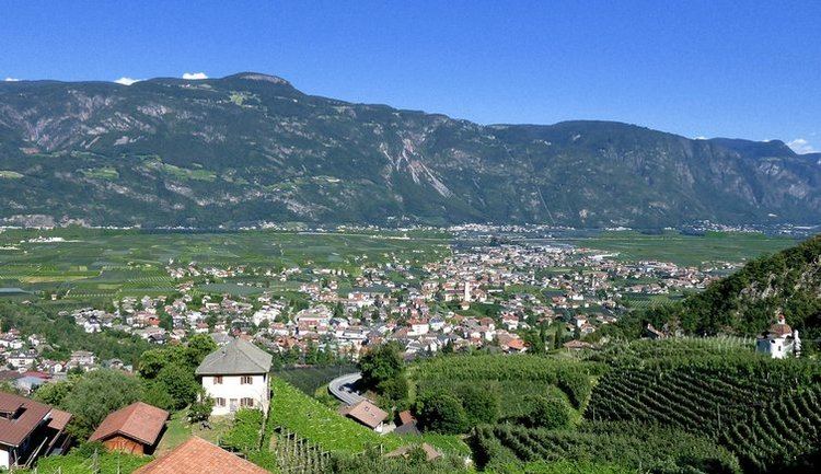
Lana ( [ˈlaːna]; [ˈlaːna]) is a comune (municipality) in South Tyrol in northern Italy. It is situated in the Etschtal (Etsch Valley) between Bolzano and Merano and at the entrance to the Ultental. The population rose to 11,206 in 2010.
Contents
- Map of 39011 Lana Province of Bolzano South Tyrol Italy
- Coat of arms
- Linguistic distribution
- Notable people
- Tourism
- References
Map of 39011 Lana, Province of Bolzano - South Tyrol, Italy
It is one of the three municipalities of South Tyrol whose name remained unchanged by the early 20th-century renaming programme which aimed at replacing mostly German place names with Italianised versions, the other two being Gais and Plaus.
Coat-of-arms
The emblem represents a Teutonic cross of sable, on argent, and a gules rampant lion on it. The lion is the arms of the Counts of Brandis who played a role in the development of the village. The emblem was adopted in 1967.
Linguistic distribution
According to the 2011 census, 91.84% of Lana's population speak German, 7.90% Italian, and 0.26% Ladin as first language.
Notable people
Tourism
Lana is a village which is divided into three parts: Oberlana, Mitterlana and Niederlana. It is a popular tourist spot offering sports such as tennis, football, golf, minigolf and ice-skating among others. During summer, locals and tourists alike enjoy swimming, hiking and cycling because there are a lot of good cycle paths.