
Formed January 1, 1998 Postal code FSA K0H Population 2,532 (2011) | Time zone EST (UTC-5) Area 1,288 km² Local time Thursday 2:58 AM Area code 613 | |
 | ||
Website www.addingtonhighlands.ca Weather -7°C, Wind NW at 21 km/h, 77% Humidity | ||
Addington Highlands (2011 population 2,532) is a township in central eastern Ontario, Canada, in the County of Lennox and Addington. Bon Echo Provincial Park is located primarily in Addington Highlands.
Contents
Map of Addington Highlands, ON, Canada
History
Addington Highlands contains Kaladar Pine Barrens Conservation Reserve and is near Puzzle Lake Provincial Park. This area was first settled following the construction of the Addington Road in 1857. It was originally named Scouten after its first postmaster. The old CPR rail bed passing through the town has become part of the Trans Canada Trail.
Geography
The township comprises the communities of Addington, Bishop Corners, Caverlys Landing, Cloyne, Denbigh, Ferguson Corners, Flinton, Flinton Corners, Glastonbury, Glenfield, Kaladar, Massanoga, McCrae, Northbrook, Rose Hill, Slate Falls, Vennachar, Vennachar Junction and Weslemkoon. The township's municipal offices are located in Flinton. Kaladar is located at the junction of Highway 7 and Highway 41.
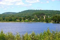
Lakes of notable size within the township boundaries are:
Parks and recreation
Addington Highlands contains the majority of Bon Echo Provincial Park.