
Major cities Whitby, Malton | North end: Whitby | |
 | ||
The A169 is an A road in North Yorkshire, England. It runs from the A64 at Malton on the edge of the Yorkshire Wolds through the Vale of Pickering and across the North York Moors to join the A171 just west of Whitby. It is a single carriageway for all of its 25 mile (40 kilometre) route. Whilst it is not considered a Primary Route nationally, the Ryedale Local Transport Plan lists it as part of its Major Road Network alongside the A64, A166 & A171.
Contents
Map of A169, United Kingdom
The moorland section between Pickering and the junction with the A171 can be problematic to travellers during winter when frost, dense fog and heavy snow are common occurrences.
Settlements on the road
Route
The B1257 connects Malton town centre with the A64. Once the B1257 reaches the A64 it becomes the A169 road to Whitby. On the north west of this junction is Eden Camp. The route then goes in a mainly northerly direction through the Vale of Pickering and crossing the confluence of the River Rye and the Costa Beck before reaching Pickering town and intersecting with the A170.
The route then goes north east and strikes out across the lush green countryside on the edge of the Dalby Forest. It enters the North York Moors National Park 2 kilometres out of Pickering near to Little Park Wood. 13 kilometres out of Pickering is a car park for taking in the superb views to west over the Hole of Horcum. Immediately after this there is a sharp 90° turn to the west followed by a sharp 180° downhill turn to the east before you pass out into the purple moorland landscape past the Saltersgate public house. Legend has it that there is the body of a Customs & Excise man buried beneath the fireplace. If the fire in the pub ever goes out, his ghost will come out and haunt the house and its patrons.
3 kilometres after the Hole of Horcum is the turning for RAF Fylingdales and another sharp bend in the road over Eller Beck Bridge. This is where the Lyke Wake Walk route crosses the A169. This one bends east first then west and is not a severe as that approaching Saltersgate. Here you pass the first turn for Goathland as the route strikes out across Widow Howe Moor and Low Moor. There are some places to stop along the moorland route and it is popular with walkers. After this there is a descent and ascent over Brocka Beck Bridge before the second turn for Goathland. At the junction is Sleights Moor, another turn off the road (this time for Grosmont) and then you happen across another viewpoint which looks north east across to Larpool Viaduct and Whitby.
From here downhill is the steep 1 in 5 (20% gradient) of Blue Bank which has an escape route on the northbound side as you go downhill and high friction surface tarmac to aid in braking. At the bottom of Blue Bank is the turn for Grosmont and the route is mostly downhill from here with some gentle gradients and some steeper as you descend into the village of Sleights. At the bottom of the valley you cross the River Esk and the Middlesbrough to Whitby Railway line across Sleights Bridge. This bridge was built in 1937 to replace a bridge that was swept away in the flood of 1930.
Immediately after the bridge is the east turn for the B1410 into Ruswarp, then it is up out of the valley on a much gentler climb until the road reaches a roundabout junction with the A171. Eastwards it is 3 miles (5 kilometres) into Whitby and westwards it is 29 miles (47 kilometres) to Middlesbrough.
Conservation
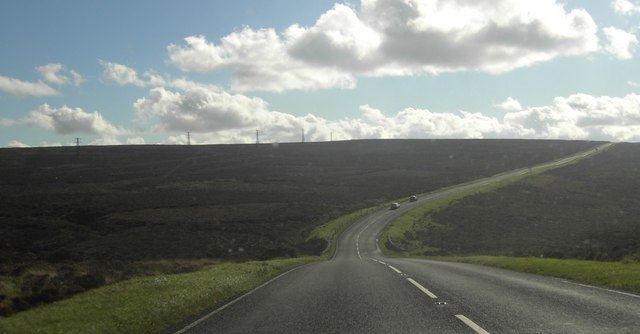
The route passes through two SSSIs when north of Pickering: Hole of Horcum and Newtondale. According to the Landscape Conservation Action Plan, the scenery and view alongside the moorland section of the A169 has been blighted by the pylons that run alongside the road and across the moor. In 2015, Northern Powergrid started remedial works to remove the pylons and associated electrical equipment and replace them with a sub-surface cable power network.
Safety
North Yorkshire Police have mobile speed cameras placed on the road at random times. These cameras have been recording in positions where people have been killed or seriously injured and at designated motorcycle incident points (the route is recognised as being 'used by motorcycles that has a high incidence of collisions and anti social behaviour.' Serious offenders summonsed to court were as follows; 20 in 2013, 11 in 2014 and 8 up to August 2015.
Public transport
Buses operate on the route between Malton and Whitby. The Coastliner service runs from Leeds to York and onto Malton (via the A64) 3 times hourly. Of these, an hourly service operates to Pickering with 3 a day going on to Whitby via the A169.