
Basin area 362 km² | - average 4.8 m/s (170 cu ft/s) Length 45 km | |
 | ||
- max 350 m/s (12,360 cu ft/s) | ||
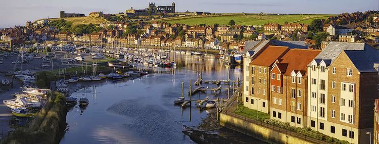
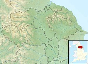
The River Esk is a river in North Yorkshire, England that empties into the North Sea at Whitby after a course of around 28 miles (45 km) through the valley of Eskdale, named after the river itself.
Contents

OverviewEdit
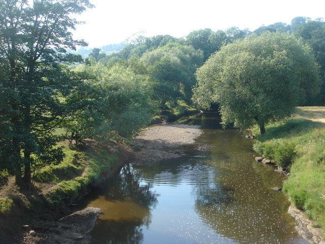
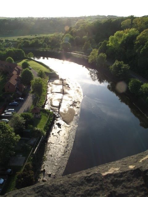
Due to its rural nature, the river is clean and healthy, supporting a wealth of wildlife. Salmon spawn right up through Eskdale, and a number of "leaps" are provided to enable them to travel through weirs on the course. There are clearly visible examples at Ruswarp, where the tidal stretch through to Whitby begins and at Sleights. Around Whitby the Esk has a large population of sea trout, and the river is noted for freshwater pearl mussels, although these are threatened with extinction due to buildups of silt in the river. The Esk is also the only major river in Yorkshire to drain directly into the North Sea.

The river rises at the Esklets on Westerdale Moor in the North York Moors, flowing through Westerdale before merging with a large number of becks from the surrounding hills, including Tower, Baysdale, Sleddale, Danby, Great Fryup, Stonegate, Glaisdale and Murk becks. Running east through the valley known as Eskdale it leaves the moors via the villages of Sleights and Ruswarp, between which it forms the boundary of the North York Moors, and reaches the North Sea three miles later by bisecting the resort of Whitby.
Partway down the river at Danby Bridge, there is a ford in which vehicles can get trapped.
Between the junction of Fryup Dale and Lealholm the river passes through a narrow, steep-sided and wooded valley known as Crunkly Ghyll. Here the river drops 100 feet (30 m) from the valley above to reach the village. Crunkly Ghyll was formed during the last great ice age as a huge wall of ice moved across the landscape carving out what is now the Esk Valley as far as Lealholm. At its head it formed a massive dam blocking the flow of water from above and creating a lake running back up the valley to Commondale. As the ice melted, the river forced its way out carving the ravine we see today. In Victorian times, the Ghyll was home to a large rockery garden, open to the public, but long since washed away by flooding of the river.
The small villages along the river were at one time of great importance to the north-east, with coal mined in the valleys, and iron ore dug from quarries on the surrounding moors. Today, all that remains are the deserted mine shafts, though potash is mined, near Boulby, with tunnels running six miles beneath the sea, some of the deepest in Europe.
River Esk Tideway Bylaw 1987Edit
Since 1987 a bylaw has been in place to protect dangerously dwindling populations of salmon and sea trout. The River Esk Tideway Bylaw 1987, prevents fishing for salmon and sea trout along the stretch of the Esk between Ruswarp and Whitby known as the tideway. The Environment Agency enforces the byelaw under s210 and Schedule 25 of the Water Resources Act 1991. The bylaw was renewed in 1997 for 5 years, then again in 2002 for 10 years. After a peak of 924 rod-caught salmon per year in 1965, the number dropped to just 11 in 1989. This was due mainly to illegal poaching of stocks from this stretch under the guise of angling. Since the bylaw was introduced and enforced, the numbers of rod-caught salmon per year, further upstream, has increased each year (to 177 in 2010).
SettlementsEdit
from source
(flows into the North Sea)
The Esk Valley Walk runs along part of the length of the river.