
River mouth Howe Bridge Basin area 854 km² | Basin size 330 sq mi (850 km) Source elevation 200 m Country United Kingdom | |
 | ||
Main source Cleveland Hills660 ft (200 m) | ||
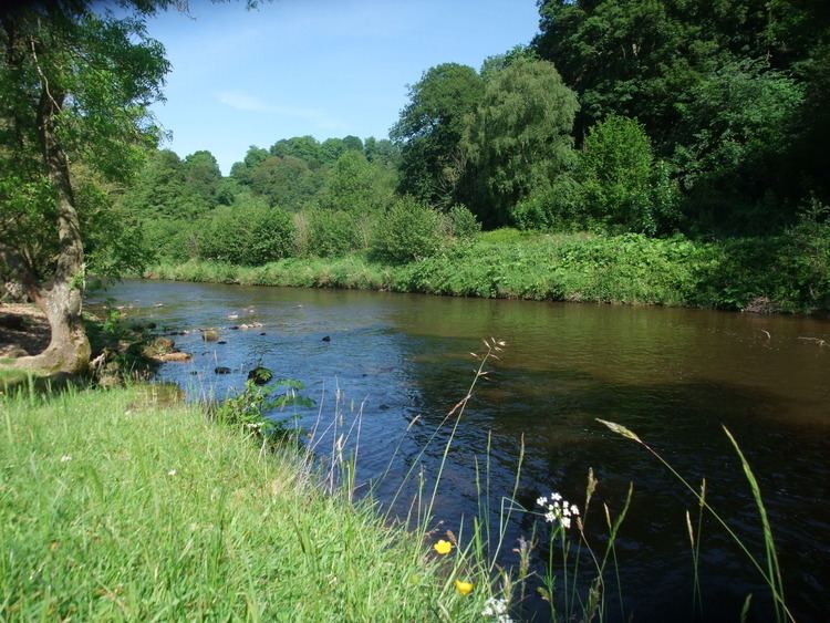
The River Rye is a river in the English county of North Yorkshire. It rises just south of the Cleveland Hills, east of Osmotherley, and flows through Hawnby, Rievaulx, Helmsley, Nunnington, West and East Ness, Butterwick, Brawby, and Ryton, before joining the River Derwent at 54°10′N 00°44′W near Malton.
Contents
- Map of River Rye United Kingdom
- Course
- Areas
- Ness
- Howe Bridge
- Natural history
- Geology
- History
- Economy
- References
Map of River Rye, United Kingdom
On some stretches of the river there is a conflict of interests between abstraction of water for economic purposes and the maintenance of a flow which is of sufficient quantity and quality to support the ecology of the area.
Course
The upper valley of the river is known as Rye Dale. the river rises at Rye Head in the Cleveland Hills, then collects the River Seph which flows along Bilsdale. It passes Rievaulx Abbey then enters the Vale of Pickering at Helmsley. In its eastward course from Helmsley the Rye receives the River Dove from Farndale which has previously added the Hodge Beck from Bransdale. Hodge Beck is partly swallowed by the limestone aquifer in Kirkdale and issues again further down the valley. Kirkbymoorside is on the River Dove which, like Hodge Beck has a partly subterranean course. Rosedale sends down the River Seven which comes by Sinnington to join the Rye. The steep sided Newtondale gives Pickering Beck which joins the Costa Beck before it enters the River Rye just before its mouth.
Areas
For management purposes the River Rye is divided into two units, Ness and Howe Bridge.
Ness
Ness is the more upstream area and covers 59,000 acres (240 km2). It covers the River Rye and its tributaries from its source to its confluence with the River Dove near the village of East Ness.
The Ness area is mainly rural with a few dispersed settlements. It has varied topography with the northern part of the area dominated by upland moors which are over 660 feet (200 m) in height and part of the North York Moors National Park. Here the land use is largely as managed grassland. Downstream, as the river approaches Rievaulx and Helmsley the land is around 330 feet (100 m) in height and falls to 160 feet (49 m) at East Ness. In the lower part of the area the land use is a mixture of managed grassland and arable farming. There are also some pockets of forestry and woodland on the land close to the river.
Abstraction from the river is mainly to supply a fish farm at Harome and this water is returned to the river. There are two wastewater treatment works at Helmsley and Sproxton. The ecology and fisheries have a very high sensitivity to changers in water flow in this area.
Howe Bridge
The Howe Bridge area covers 152,000 acres (620 km2). It consists of the River Rye from East Ness to its confluence with the River Derwent just beyond Howe Bridge. In this area the main tributaries of the Rye are the River Riccal, River Dove (with Hodge Beck), River Seven, Costa Beck and Pickering Beck.
The market towns of Pickering and Kirkbymoorside are the largest settlements in the area. Otherwise the area is rural with a varied topography. To the north is the upland moorland of the North York moors with the valleys of Bransdale, Farndale, Rosedale and Newtondale. Much of the moorland is over 980 feet (300 m) in height with the highest point being 1,410 feet (430 m). To the south of this upland the tributaries from the valleys converge and the land becomes flatter. It is mainly less than 330 feet (100 m) in height. To the south-west the Howe Bridge area covers the undulating landscape of the Howardian Hills.
The largest abstractions from the river are for fish farming. There are wastewater treatment works at Pickering, Harome and Kirkbymoorside.
Natural history
There are many sites in the Rye catchment area which have designated status.
Duncombe Park is a National Nature Reserve (NNR) and the Howardian Hills are an Area of Outstanding Natural Beauty.
Geology
At source the River Rye and its tributaries run over Corallian limestone which outcrops on the hills surrounding the Vale of Pickering. In places this major aquifer is exposed in the river bed and water from the river is lost through swallow holes at Kirkdale and Kirkby Mills. Beneath the course of the Rye and its tributaries in the Vale of Pickering lie the lacustrine deposits from the last ice age. Newtondale was a melt water channel draining the North York Moors at the end of the ice age and its valley is much more deeply incised than the flow of the present Pickering Beck would suggest.
History
The upland streams of the Rye and its tributaries have powered water mills for many centuries. There were certainly three at Pickering and others at Kirkby Mills, near Kirkbymoorside. A mill at Bransdale is owned by the National Trust, though not open to visitors. Rievaulx Abbey was established on the banks of the Rye on land given by Walter l'Espec of Helmsley and took its name from a literal translation of Rye Valley from the French. The monks of Rievaulx later diverted the river away from the abbey buildings.
On the Costa Beck south of Pickering traces of a prehistoric settlement were excavated in the late 19th century.
Economy
The main economic value of the River Rye lies in its use as a water source for agriculture, domestic supply, fisheries and leisure pursuits. It is also used to drain the water discharged by wastewater treatment works.