Existed: 1967 – present Length 211 km | Constructed 1967 | |
 | ||
Major cities | ||
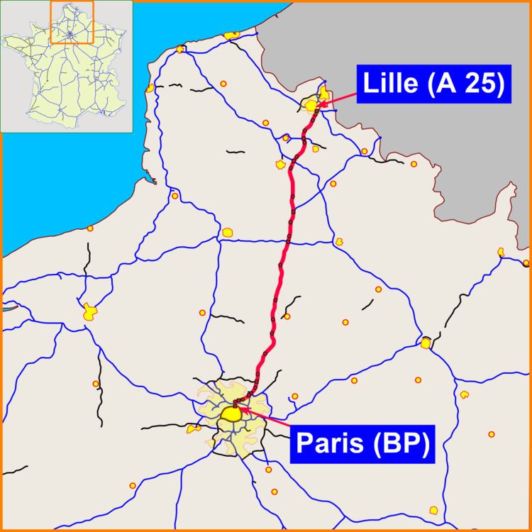
The A1 Autoroute, also known as l'autoroute du Nord (the Northern Motorway), is the busiest of France's autoroutes. With a length of 211 km (131 mi), it connects Paris with the northern city of Lille. It is managed by the Société des Autoroutes du Nord et de l'Est de la France (SANEF). The autoroute serves the northern suburbs of Paris, including the Stade de France, Le Bourget, Paris' Roissy Charles de Gaulle Airport, and Parc Astérix. From there it crosses Picardy, without directly passing through any of the major cities of the région. Throughout Picardy, the A1 runs parallel to the LGV Nord.
Contents
Map of Autoroute du Nord, France
Around 120 km (75 mi) from Paris, between the towns of Amiens and Saint-Quentin and near the Aire de service d'Assevillers (the largest motorway plaza in Europe), the A1 crosses over the A29. A few dozen kilometers further north it forms the southern terminus of the A2, which branches off towards Brussels. The A1 is also crossed by the A26 and the A21, and it makes up part of European routes E15, E17, and E19. At its northern terminus, the A1 turns into the A25.
