
Elevation 1,100 m (3,600 ft) Postal code 68xxx Area 3,850 km² Area code 0382 | Region Central Anatolia Time zone EET (UTC+2) Licence plate 68 Local time Sunday 9:10 PM | |
 | ||
Weather 6°C, Wind N at 3 km/h, 76% Humidity | ||
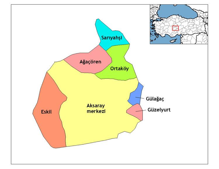
Ağaçören, formerly Panlı, is a town and district of Aksaray Province in the Central Anatolia region of Turkey. According to 2000 census, population of the district is 15,869 of which 4,983 live in the town of Ağaçören. The district covers an area of 395 km2 (153 sq mi), and the average elevation is 1,100 m (3,609 ft).
Contents
- Map of AC49FaC3A7C3B6ren 68600 AC49FaC3A7C3B6ren2FAksaray Turkey
- A a ren zt rk awm hirsiz 3
- References
Map of A%C4%9Fa%C3%A7%C3%B6ren, 68600 A%C4%9Fa%C3%A7%C3%B6ren%2FAksaray, Turkey
A a ren zt rk awm hirsiz 3
References
Ağaçören Wikipedia(Text) CC BY-SA