
First system formed 8 November 1988 Severe tropical cyclones 6 | Last system dissipated 12 May 1989 Tropical cyclones 13 Total fatalities 6 direct | |
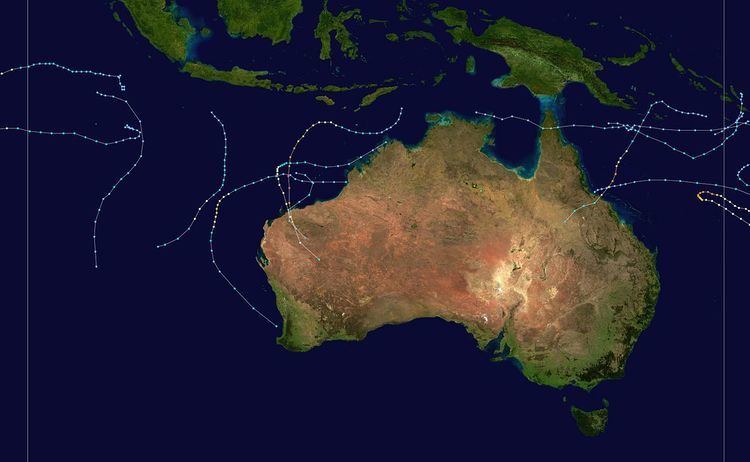 | ||
The 1988–89 Australian region cyclone season was an event in the cycle of tropical cyclone formation. It officially started on 1 November 1988, and officially ended on 30 April 1989. The regional tropical cyclone operational plan defines a "tropical cyclone year" separately from a "tropical cyclone season"; the "tropical cyclone year" began on 1 July 1988 and ended on 30 June 1989.
Contents
- Tropical Cyclone Barisaona
- Severe Tropical Cyclone Ilona
- Tropical Cyclone Delilah
- Tropical Cyclone John
- Severe Tropical Cyclone Kirrily
- Tropical Cyclone LeonHanitra
- Severe Tropical Cyclone Harry
- Tropical Low 16S
- Tropical Cyclone Marcia
- Severe Tropical Cyclone Ned
- Severe Tropical Cyclone Aivu
- Severe Tropical Cyclone Orson
- Tropical Cyclone Meena
- Tropical Cyclone Ernie
- References
Tropical Cyclone Barisaona
On 5 November, the JTWC started to monitor a tropical disturbance, that was located about 840 km (520 mi) to the southeast of Jakarta, Indonesia. Over the next 24 hours the disturbance remained near stationary before moving slowly towards the north-west over the next few days. The JTWC then initiated advisories on Tropical Cyclone 02S during 8 November, with 1-minute sustained windspeeds equivalent to a tropical storm on the SSHS. During that day while 02S continued to move towards the west, 02S intensified quickly to obtain 1-minute sustained windspeeds of 100 km/h (65 mph). The system continued to move westwards without intensifying any further until it moved into the South-West Indian Ocean during 11 November where it was named Barisaona, by the Mauritius Meteorological service. According to the Reunion Meteorological Service, Barisaona ultimately peaked on 16 November with 10-minute sustained windspeeds of 140 km/h (85 mph), while the JTWC estimated that the cyclone peaked on 17 November with 1-minute windspeeds of 185 km/h (115 mph). The cyclone then dissipated around 23 November.
While Barisaona was in the Australian region TCWC Perth did not monitor it as a named storm. However, when the system was added to their database, it was estimated that while it was in the Australian region it had peaked as a Category 2 tropical cyclone with 10-minute windspeeds of 95 km/h (60 mph).
Severe Tropical Cyclone Ilona
Ilona developed off the Western Australian coast on 12 December 1988 and made landfall northeast of Onslow, Western Australia on 17 December 1988. Ilona attained a minimum central pressure of 960 mb and maximum wind speed of 85 knots.
Tropical Cyclone Delilah
The tropical low that was to develop into Tropical Cyclone Delilah, was first noted within the South Pacific convergence zone during 28 December to the northeast of Townsville in Queensland, Australia. Over the next few days the system moved eastwards and slowly intensified further before TCWC Brisbane named it Delilah, during 1 January after it had developed into a category 1 tropical cyclone on the Australian scale. Later that day as the system started to move south-eastwards it crossed 160°E and moved out of the Australian region into the South Pacific basin.
Tropical Cyclone John
On 20 January, an area of convection near Sumatra within a monsoon flow became increasingly organised. By 23 January, a low pressure area developed to the northwest of Christmas Island and the system was classified a tropical low. Initially moving southeast, the system later turned west-southwest on 24 January. Two days later, the system passed just 20 km (12 mi) north of the Cocos Islands, where wind gusts reached 70 km/h (43 mph) and pressures dropped to 999 mb (hPa; 29.50 inHg). After bypassing the islands, the low attained gale-force winds and was named Tropical Cyclone John. The cyclone reached its peak strength on 26 January with winds of 75 km/h (45 mph) and a pressure of 990 mbar (hPa; 29.24 inHg). John's forward motion slowed by this time as it began recurving east and southeast. By 29 January, the accelerating storm struggled to maintain its structure and was left with an exposed circulation. Weakening below cyclone strength that day, John continued over the open waters of the southeast Indian Ocean before completely losing its identity on 2 February well to the west of Australia.
Severe Tropical Cyclone Kirrily
Severe Tropical Cyclone Kirrily existed from 3 February to 11 February.
Tropical Cyclone Leon–Hanitra
A weak tropical low formed between the Cocos and Christmas Islands on 13 February. Moving along a slow, generally westward track, the system steadily organised. After passing south of the Cocos Islands on 17 February, where it produced wind gusts up to 45 km/h (28 mph) it reached cyclone strength on 18 February. Steady strengthening ensued as the newly named Leon approached the western bounds of the Australian cyclone region. Before crossing 90°E on 19 February, it attained winds of 85 km/h (50 mph) and a pressure of 988 mb (hPa; 29.18 inHg). Responsibility of warnings was subsequently passed on to the Mauritius Meteorological Service, at which time it was given the name Hanitra. Cyclone Leon–Hanitra ultimately attained peak winds of 150 km/h (90 mph) and a pressure of 940 mb (hPa; 27.76 inHg) before turning south and becoming extratropical.
Severe Tropical Cyclone Harry
On 7 February, an eastward moving tropical depression developed about 800 km (500 mi) west of Vanuatu. After intensifying to a tropical cyclone the following day, Harry turned southward and further intensified to a severe tropical cyclone before striking New Caledonia on 11 February. After moving back over water, the cyclone turned towards the east-northeast and crossed 160°E, entering the Australian cyclone basin, on 13 February. Harry gradually strengthened over the following two days, ultimately attaining its peak intensity on 15 February with winds of 185 km/h (115 mph) and a minimum pressure of 925 mbar (hPa; 27.31 inHg). Around this time, the cyclone's eye had expanded to 85 km (50 mi) in diameter. Throughout the remainder of 15 February and into the following day, Harry became almost stationary before turning towards the southwest. By 17 February the storm weakened below severe tropical cyclone status before exiting the Australian Basin.
Tropical Low 16S
On 23 February the BoM started to monitor a tropical low that had developed within the monsoon trough about 1,665 km (1,035 mi) to the north of Perth, Western Australia. Over the next day the system moved southwards before it was designated as Tropical Cyclone 16S by the JTWC, as it reached its peak intensity with 1-minute sustained wind speeds of 85 km/h (50 mph). The system subsequently made landfall on Western Australia during 24 February, having nearly become a tropical cyclone on the Australian scale. The system was subsequently last noted over Western Australia during 25 February.
Tropical Cyclone Marcia
Tropical Cyclone Marcia existed from 2 March to 5 March.
Severe Tropical Cyclone Ned
Occurring between 26 March to 31 March 1989, Ned crossed the Western Australian coast near Rockingham on 1 April 1989.
Prior to Ned's landfall, emergency services across Perth, Western Australia were placed on stand-by. Across southwestern Western Australia, Ned brought gusty winds that caused scattered power outages. In the Perth metropolitan area, gusts peaked at 110 km/h (68 mph) and caused some roof damage. Winds in excess of 100 km/h (62 mph) also took place on Rottnest Island and in Fremantle. Possible gales were observed just south of the Perth metro area in Rockingham. High winds in Collie caused a starting pontoon along the Wellington Dam course in the Australian Rowing Championships to sink. This prompted referees at the event to cancel the remainder of the race. The entire King's Cup portion of the championships was abandoned, marking the first time since World War II that it was cancelled. Excluding times of war or depression, it was the first time in the 111 years of the King's Cup that it had been abandoned entirely. Following the storm, the name Ned was retired and will never be used again for an Australian cyclone.
Severe Tropical Cyclone Aivu
Aivu made landfall near Ayr, Queensland on April 4, 1989, causing serious damage and killing one person.[1]
Severe Tropical Cyclone Orson
Forming out of a tropical low on 17 April, Orson gradually intensified as it tracked towards the west. After attaining Category 5 intensity on 20 April, the storm began to track southward and accelerated. The following day, the cyclone reached its peak intensity with winds of 250 km/h (155 mph) and a barometric pressure of 904 hPa (mbar). Orson maintained this intensity for nearly two days before making landfall near Dampier. The cyclone rapidly weakened after landfall as it accelerated to the southeast. After moving into the Great Australian Bight on 24 April, the storm dissipated.
Despite Orson's extreme intensity, damage was relatively minimal as it struck a sparsely populated region of Western Australia. Five people were killed offshore and damages amounted to 7007200000000000000♠A$20 million (7007168000000000000♠US$16.8 million). The storm damaged a new gas platform that explored a possible oil field, believed to contain nearly 200 million barrels (32,000,000 m3) of oil. The damage delayed the project for nearly two weeks. The most severe impacts took place in Pannawonica, where 70 homes were damaged. Following the storm, cleanup costs reached A$5 million (US$4.1 million). Due to the severity of the storm, the name Orson was retired after the season.
Tropical Cyclone Meena
On 5 May Tropical Cyclone Meena moved into the Australian region, from the South Pacific region as a category 1 tropical cyclone. During the next day the system continued to move towards the southwest, before the BoM estimated during 6 May that the system had reached its peak intensity with 10-minute sustained wind speeds of 85 km/h (50 mph). At around the same time the JTWC also estimated that the system had peaked as a tropical storm, with 1-minute sustained wind speeds of 95 km/h (60 mph). Over the next couple of days the system weakened as it moved westwards, before it made landfall on the Cape York Peninsular during 9 May. The systems remnants subsequently emerged into the Gulf of Carpentaria, where they dissipated during the following day. There were no reports of any damage to the Cape York Peninsular though it was noted that Meena may have been responsible for some minor damage to the Peninsular.
Tropical Cyclone Ernie
Tropical Cyclone Ernie existed from 9 May to 12 May.