
Car plates WZY Capital Żyrardów | Seat Żyrardów Area 532.6 km² | |
 | ||
Gminas Total 5 (incl. 1 urban)ŻyrardówGmina MszczonówGmina Puszcza MariańskaGmina RadziejowiceGmina Wiskitki Points of interest Radziejowice Castle, Zalew Żyrardowski, Park Dittricha, Muzeum Mazowsza Zachodni, Dwór z XVIII wieku | ||
Żyrardów County (Polish: powiat żyrardowski) is a unit of territorial administration and local government (powiat) in Masovian Voivodeship, east-central Poland. It came into being on 1 January 1999, as a result of the Polish local government reforms passed in 1998. Its administrative seat and largest town is Żyrardów, which lies 43 kilometres (27 mi) south-west of Warsaw. The only other town in the county is Mszczonów, lying 11 km (7 mi) south-east of Żyrardów.
Contents
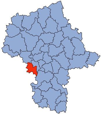
Map of %C5%BByrard%C3%B3w County, Poland
The county covers an area of 532.63 square kilometres (205.6 sq mi). As of 2006 its total population is 74,662, out of which the population of Żyrardów is 41,161, that of Mszczonów is 6,231, and the rural population is 27,270.
Neighbouring counties
Żyrardów County is bordered by Grodzisk Mazowiecki County to the east, Grójec County to the south-east, Rawa County to the south, Skierniewice County to the west and Sochaczew County to the north-west.
Administrative division
The county is subdivided into five gminas (one urban, one urban-rural and three rural). These are listed in the following table, in descending order of population.