
Car plates WZW Population 37,183 (2006) | Seat Zwoleń Area 571.2 km² Capital Zwoleń | |
 | ||
Gminas Total 5Gmina KazanówGmina PolicznaGmina PrzyłękGmina TczówGmina Zwoleń Points of interest Muzeum Jana Kochano, Rezerwat przyrody Okólny Ług, Rezerwat przyrody Miodne, Pomnik Jana Kochanowskiego, Zegar Słoneczny | ||
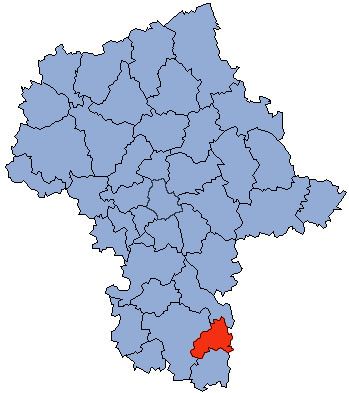
Zwoleń County (Polish: powiat zwoleński) is a unit of territorial administration and local government (powiat) in Masovian Voivodeship, east-central Poland. It came into being on January 1, 1999, as a result of the Polish local government reforms passed in 1998. Its administrative seat and only town is Zwoleń, which lies 104 kilometres (65 mi) south-east of Warsaw.
Contents
Map of Zwole%C5%84 County, Poland
The county covers an area of 571.24 square kilometres (220.6 sq mi). As of 2006 its total population is 37,183, out of which the population of Zwoleń is 8,176 and the rural population is 29,007.
Neighbouring counties
Zwoleń County is bordered by Kozienice County to the north, Puławy County to the east, Opole Lubelskie County to the south-east, Lipsko County to the south and Radom County to the west.
Administrative division
The county is subdivided into five gminas (one urban-rural and four rural). These are listed in the following table, in descending order of population.