
Country France Population 1,713 (1999) | Area 16.41 km² Local time Sunday 4:44 PM | |
 | ||
Weather 14°C, Wind NW at 14 km/h, 72% Humidity | ||
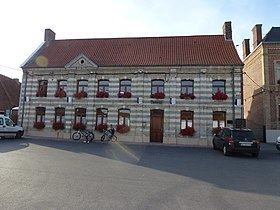
Zudkerque is a commune in the Pas-de-Calais department in the Hauts-de-France region of France.
Contents
Map of 62370 Zutkerque, France
Geography
Zutkerque is located 11 miles (17 km) northwest of Saint-Omer, at the D226 road junction with the D191.
History
Zutkerque had a castle in Roman times, known as the Promontory. Mentioned for the first time in 1084, its name comes from Dutch and means "South church".
In 1396, Philip the Bold, Duke of Burgundy stayed at the castle. The English occupied it in the year 1405. Louis XI took it back in 1477 and king Henry VII fought and won it again in 1488. Finally, in 1542 the French, under Antoine de Bourbon, duke of Vendôme, re-took it and completely destroyed the castle.
In May 1595, the village church was looted by the French. On 7 August 1635, a body of Spanish troops, from Saint-Omer, seized the town. In 1638, the French seized the village back again.