Sneha Girap (Editor)

Zulia

Updated on
Edit
Like
Comment
Share on FacebookTweet on TwitterShare on LinkedInShare on Reddit
Country
  
Venezuela

Area
  
63,100 km2

Capital
  
Maracaibo

Governor
  
Francisco Arias Cárdenas

Population
  
3,704,404

Destinations
  
Maracaibo, Cabimas, Ciudad Ojeda, Santa Bárbara del Zulia, Machiques

Colleges and Universities
  
University of Zulia (Maracaibo), Dr Rafael Belloso Chacin University (Maracaibo), Universidad Rafael Urdaneta (Maracaibo), Universidad Dr José Gregorio Hernández (Maracaibo), Universidad Católica Cecilio Acosta (Maracaibo)


Zulia (Spanish: , ) is one of the 23 states of Venezuela. The state capital is Maracaibo. As of June 30, 2010, it had an estimated population of 3,821,068, the largest population among Venezuelas states. It is also one of the few states (if not the only one) in Venezuela where voseo is widely used.

Contents

Map of Zulia

Zulia State is located in the northwest of Venezuela, around Maracaibo Lake. This lake is the largest body of water of its kind in Latin America and its basin covers one of the largest oil and gas reserves in the Western Hemisphere.

Maracaibo zulia venezuela south america


Zulia is economically important to the country due to its oil and mineral exploitation, but it is also one of the major agricultural areas of Venezuela, highlighting the regions contribution in areas such as livestock, bananas, fruits, meat and milk, among others.

Geography

Zulia Beautiful Landscapes of Zulia

Lake Maracaibo, the largest lake in South America, lies within Zulia. The Lake Maracaibo Basin covers the largest oil and gas reserves in the Western Hemisphere. A long and mostly uninhabited border separates Venezuela from Colombia to the north and west, from the Guajira Peninsula to the Perijá Mountains. Venezuelas Andean states of Táchira, Mérida and Trujillo border Zulia State at the southern end of Lake Maracaibo and finally the states of Lara and Falcón complete the boundaries of Zulia.

Zulia Beautiful Landscapes of Zulia

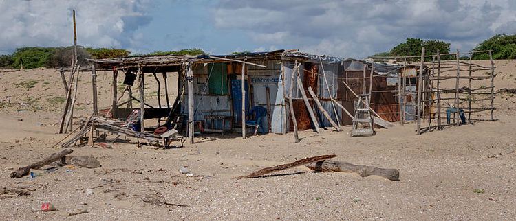
The name Venezuela comes from the lake. When Spanish conquistadors sailed into the area, they found the indigenous peoples living in communities of huts supported by stilts along the shores of the lake. They were reminded of Venice, and named the place "Little Venice" or Venezuela. The lake has a number of islands, some of which are populated.

Near the mouth of the Catatumbo River, where it empties into Lake Maracaibo, is the famous Catatumbo lightning (Relámpago del Catatumbo) which is represented on the states flag and coat of arms by lightning bolts.

History

Zulia in the past, History of Zulia

Zulia was first seen by Europeans in 1499 during an expedition commanded by Alonso de Ojeda. During the Spanish colonial period, its lands were part of the Venezuela Province until 1676, when its lands were added to the Province of Mérida del Espiritu Santo de la Grita, becoming the province Espiritu Santo de Maracaibo, or Maracaibo Province. In 1789, this province covered the territory of the current Venezuelan states of Zulia, Apure, Barinas, Táchira, Mérida and Trujillo. In 1810, Mérida and Trujillo were separated as new provinces. The Zulia Province declared independence from Spain on January 28, 1821. During the Gran Colombia period in 1824, it received the name of "Zulia Department", honoring the Zulia River. With the dissolution of Gran Colombia in 1830, it was named Maracaibo Province, and was one of the 11 provinces of Venezuela during this period.

Zulia in the past, History of Zulia

Venezuelas federal constitution, April 22, 1864, changed the denomination of "province" to "state", creating the State of Maracaibo on the same territory as the province. At the end of the same year, the states legislation determined to change the name to the Sovereign State of Zulia but this lasted only a few months. In 1874, its name again became Zulia State. Federal government orders in 1881 created the combined Falcón Zulia state. Its autonomous state status continued until April 1, 1890, when congress legislated the separation of the Falcon-Zulia State. It suffered further territorial changes towards the end of the 19th century, until the current delimitation in 1899 was finally drawn. Since that time the name has remained Estado Zulia.

References

Zulia Wikipedia (,)http://upload.wikimedia.org/wikipedia/commons/thumb/5/51/Rancher%25C3%25ADa_de_Pescadores_en_la_Bah%25C3%25ADa_de_San_Carlos,_Isla_San_Carlos,_Estado_Zulia.jpg/800px-Rancher%25C3%25ADa_de_Pescadores_en_la_Bah%25C3%25ADa_de_San_Carlos,_Isla_San_Carlos,_Estado_Zulia.jpg(,)http://geocurrents.info/wp-content/uploads/2012/06/Zulia.jpg(,)http://upload.wikimedia.org/wikipedia/commons/a/aa/Venezuela.gif(,)http://upload.wikimedia.org/wikipedia/commons/a/af/Palafito.jpg(,)http://matius.weebly.com/uploads/9/4/4/0/9440186/2157788_orig.jpg(,)http://www.cclausen.net/ebvjpgs/frank_boland2.jpg(,)http://cdn1.vtourist.com/19/2002127-Landscape_of_Concha_Concha.jpg(,)http://scontent-a.cdninstagram.com/hphotos-xpa1/t51.2885-15/927709_550514175058334_105699293_n.jpg(,)http://www.tmyun.com/mid/yun_568.jpg(,)http://40.media.tumblr.com/273ba239df30b8c4de1348581c676f2a/tumblr_ncsspc9Avu1qjqktwo1_1280.jpg(,)http://farm9.static.flickr.com/8517/8404923747_af54e129b4_s.jpg(,)http://collections.lib.uwm.edu/utils/ajaxhelper/%3FCISOROOT%3Dags_south%26CISOPTR%3D404%26action%3D2%26DMSCALE%3D15%26DMWIDTH%3D512%26DMHEIGHT%3D461%26DMX%3D0%26DMY%3D0%26DMTEXT%3D%26DMROTATE%3D0(,)http://collections.lib.uwm.edu/utils/ajaxhelper/%3FCISOROOT%3Dags_south%26CISOPTR%3D453%26action%3D2%26DMSCALE%3D15%26DMWIDTH%3D512%26DMHEIGHT%3D465%26DMX%3D0%26DMY%3D0%26DMTEXT%3D%26DMROTATE%3D0(,)http://cache1.asset-cache.net/gc/97977722-venezuela-zulia-sinamaica-salt-deposits-near-gettyimages.jpg%3Fv%3D1%26c%3DIWSAsset%26k%3D2%26d%3Ds8S5f1Y0hh9cfqK15tnkU%252BMIW9wpttkqUpnTr7%252Bx4HA%253D(,)http://41.media.tumblr.com/2618b72ba35d1df3e670357ba94949ad/tumblr_na9hr98H6T1qjqktwo1_1280.jpg(,)http://cdn4.vtourist.com/19/3526779-View_from_Sinamaica_Restaurant_Table_Sinamaica.jpg(,)http://ionevoxxi.files.wordpress.com/2013/01/venezuela-food-shorta_baid2.jpg%3Fw%3D620%26h%3D435(,)http://venezuelanalysis.com/files/imagecache/images_set/images/2014/08/contrabando-incautaron-g.jpg(,)http://cdn3.vtourist.com/19/2322176-Step_into_MediteraneanNorth_Africa_SanFrancisco.jpg(,)http://ionevoxxi.files.wordpress.com/2012/10/optimized-comida.jpg%3Fw%3D620%26h%3D465(,)http://venezuelanalysis.com/files/imagecache/images_set/images/2013/06/mercado_inflacion_980x600_3-11.jpg(,)http://cdn3.vtourist.com/19/7160277-Caribbean_food_in_an_Historical_Street_Maracaibo.jpg%3Fversion%3D2(,)http://www.mapsofworld.com/venezuela/maps/zulia-map.jpg(,)http://thelibertybeat.com/wp-content/uploads/2013/06/rationing-ration-for-everyone.jpg(,)http://www.embavenez-uae.org/imagenes/060-BaileTipico.jpg(,)http://asianlite.com/wp-content/uploads/2014/12/eb0ec0c6456c6864648a5ce398e56df8.jpg(,)http://i.telegraph.co.uk/multimedia/archive/02805/potd-lightning_2805473k.jpg(,)http://i.ytimg.com/vi/byeNSWUjW0A/maxresdefault.jpg(,)http://i.ytimg.com/vi/Jx4MFG4GBgw/maxresdefault.jpg(,)http://www.venezuelatuya.com/902/img/3915768236.jpg(,)http://i.ytimg.com/vi/6wjopn8cTdU/hqdefault.jpg(,)http://www.venezuelareport.com/wp-content/uploads/2009/06/maracaibo-bridge.jpg(,)http://i1.ytimg.com/vi/1GYq5AbY1pk/0.jpg(,)https://jenho74.files.wordpress.com/2012/08/zulia-girl-portrait_37895_600x450.jpg%3Fw%3D487(,)http://www.tealca.com/uploads/imgfck/image/machiques-staBarbara(1).jpg(,)http://blog.centrovenezolano.com/wp-content/uploads/2012/11/zulia.jpg(,)https://fbcdn-sphotos-e-a.akamaihd.net/hphotos-ak-ash4/999539_10151445886421867_25867531_n.jpg(,)https://fbexternal-a.akamaihd.net/safe_image.php%3Fd%3DAQDmy-w5nU5HWhcz%26w%3D720%26h%3D1054%26url%3Dhttp%253A%252F%252Fupload.wikimedia.org%252Fwikipedia%252Fcommons%252Fthumb%252F0%252F06%252FColombia_-_Norte_de_Santander_-_Chinacota.svg%252F720px-Colombia_-_Norte_de_Santander_-_Chinacota.svg.png(,)https://traveltourismvenezuela.files.wordpress.com/2013/03/6e8e5-chinitamonumento.jpg%3Fw%3D480%26h%3D360(,)http://venezuelacarhire.com/archivos/modulos/modulo-galeriaFotos/imagenes/Maracaibo-calle-carabobo-1.jpg