
Country Belgium Arrondissement Leuven Postal code 3440 Local time Sunday 12:59 PM | Postal codes 3440 Population 7,983 (1 Jan 2007) Area code 011 | |
 | ||
Weather 14°C, Wind W at 6 km/h, 61% Humidity | ||
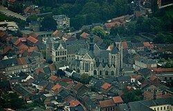
Zoutleeuw ( [ˌzʌu̯tˈleːu], French: Léau) is a municipality and city in the Hageland, in the extreme east of the Belgian province of Flemish Brabant. On 1 January 2006 the municipality had 7,947 inhabitants. The total area is 46.73 km², giving a population density of 170 inhabitants per km².
Contents
Map of Zoutleeuw, Belgium
The name Leeuw means "hill", to which Zout ("salt") was added from the 16th century in recognition of the town's right to levy a salt tax.
Other centres
As well as Zoutleeuw proper, the municipality also comprises the villages of:
References
Zoutleeuw Wikipedia(Text) CC BY-SA