
Area 4.44 km² | Bridges Zolotoy Bridge | |
 | ||
Similar Zolotoy Bridge, Popov Island, Eastern Bosphorus, Lazurnaya Bay, Russky Bridge | ||
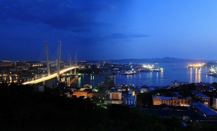
Zolotoy Rog or the Golden Horn Bay (Russian: Золотой Рог) is a sheltered horn-shaped bay of the Sea of Japan, located in coastal Primorsky Krai within the Russian Far East. Vladivostok, that lies on the hills at the head of the bay, is a major city and Russian port on the Pacific.
Contents
Map of Zolotoy Rog, Russia, 690012
Geography
It separated from the Sea of Japan's Peter the Great Gulf by Shkota Peninsula on the northwest, Cape Goldobina on the east-northeast, and Cape Tigrovy on the west.
The bay is seven kilometers long, with a width of about two kilometers and a depth ranging from 20 to 27 meters.
History
Until the mid-19th century, the bay was part of Imperial China in Manchuria, and was named "Gamat Bay".
The first European ship known to have anchored in the bay was a French whaler in 1852. During the Crimean War, the British ship Winchester visited the bay while searching for Vasily Zavoyko's squadron. The British sailors called the harbor Port May.
In 1859, Count Nikolay Muravyov-Amursky gave the bay its present name of "Zolotoy Rog", which means "Golden Horn" in Russian, alluding to a similarly shaped harbour in Constantinople.