
Area 232.7 km² | Time zone EET (UTC+2) Population 4,636 (Dec 2009) | |
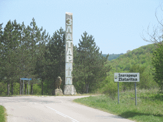 | ||
Zlataritsa Municipality (Bulgarian: Община Златарица) is a small municipality (obshtina) in Veliko Tarnovo Province, Central-North Bulgaria, located in the area of the so-called Pre-Balkan north of Stara planina mountain. It is named after its administrative centre - the town of Zlataritsa.
Contents
Map of Zlataritza, Bulgaria
The municipality embraces a territory of 232.67 km² with a population of 4,636 inhabitants, as of December 2009.
The highest point in the area is Kulata peak with 901 m above the sea level.
Settlements
Zlataritsa Municipality includes the following 24 places (towns are shown in bold):
Demography
The following table shows the change of the population during the last four decades.
References
Zlataritsa Municipality Wikipedia(Text) CC BY-SA