
Traversed by Route | Elevation 2,032 m | |
 | ||
Similar Karaca Cave, Sumela Monastery, Trabzon Atatürk Köşkü, Vazelon Monastery, Hagia Sophia - Trabzon | ||
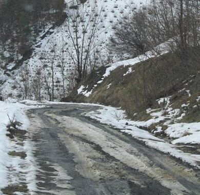
The Zigana Pass (Turkish: Zigana Geçidi) is a mountain pass situated on the Pontic Mountains in Gümüşhane Province close to its border with Trabzon Province in northeastern Turkey. The pass, at 2,032 m (6,667 ft) above sea level, is on the route at a distance of 60 km (37 mi) from Gümüşhane and 120 km (75 mi) from Trabzon at the Black Sea coast. The pass is snow-covered five months a year.
Contents
Map of Zigana Pass, 29800 Zigana K%C3%B6y%C3%BC%2FTorul%2FG%C3%BCm%C3%BC%C5%9Fhane, Turkey
The Zigana Tunnel under the pass, at an elevation of 1,795 m (5,889 ft) above sea level, is 1,702 m (5,584 ft) long, 11 m (36 ft) wide and has a maximum height of 8 m (26 ft). It is one of longest tunnels in the country.
The namesake village of Zigana, located 3.5 km (2.2 mi) southwest of the tunnel, is a popular ski-resort.
Nearby Lake Limni is reachable on foot by a 3 m (9.8 ft) trail or by car on a 11 m (36 ft) paved road via Kalkanlı village.
On 25 January 2009, an avalanche killed 11 hikers on Mount Zigana.
Gallery
Lilies at Zigana Pass