
Local time Sunday 10:01 PM | ||
 | ||
Weather 19°C, Wind SE at 16 km/h, 70% Humidity | ||
Zhombe (formerly known as Jombe) is a Communal land, a rural settlement with a few commercial farms within its borders and a handful of resettlement areas. The greater part of it makes Zhombe Constituency in the Midlands Province of Zimbabwe. Its administrative hub and capital is Zhombe Joel Growth Point located about 60 km north-west of Kwekwe and 80 km south-east of Gokwe.
Contents
- Map of Zhombe Zimbabwe
- Jombe
- Pronunciation
- Jombe Hill
- Origins of Jombe
- In Zimbabwe
- Internationally
- Zhombe Profile by Wards
- Ward 31
- Ward 2
- Ward 5
- Mabura
- Sidakeni
- Empress Mine
- Gwesela West
- Zhombe Central
- Donjane Ward 32
- Ward 11
- Ward 12
- Ward 13
- Ward 14
- Ward 15
- Ward 16
- Ward 17
- Ward 26
- Major Rivers
- Ngondoma River
- Zhombe River
- Sesombe River
- Other
- Traditional Leaders
- Historical events
- Main Village Centers in Zhombe East
- Food Security
- Water reticulation
- Developments
- Social
- Politics
- Former Council offices
- Gwesela Council
- Samambwa Council
- F2 Secondary Schools
- Kasisi Lower Primary School
- Old Loop Roads
- The Two Chiefs School Days
- The First Mission School
- Zhombe Store
- First Black School Inspector
- References
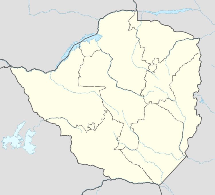
Map of Zhombe, Zimbabwe
There are 14 business centres in the Zhombe constituency. Ten of the business centres are electrified. There are also 2 Rural Service Centres , namely Empress and Joel. There were 53 Primary schools and 18 secondary schools in 2011. There are 10 clinics (and 1 mission hospital) and several health centers in Zhombe. There are over 48 000 cattle, 13 Animal Health Centers and 26 dip tanks within Zhombe constituency.
Jombe
Zhombe is still Jombe with a wrong spelling which came as a result of the French or Portuguese pronunciation. It is common that "Jo" is sometimes pronounced "Zho" in these Central African Names.
Pronunciation
Joboringo School in Charama, Gokwe, and another school of the same name near Shurugwi called Jobolinko (Ndebele form of Joboringo) were both pronounced as Zhoboringo by foreigners in colonial days. Foreigners, especially during the colonial era pronounced vernacular words in their own accent.
In French ‘’Joseph’’ is pronounced ‘’Zhozef’’. The pronunciation (spelling) of a name is however not be the spelling of the name.
For example my name is Jason and it is pronounced as JAY-sun where JAY - rhymes with BAY or SAY. Someone at the registry office misspelt my name putting it as it is pronounced__ Jaison.
In French the name Jobelle is poronounced "zho-buhl" not "jo-bel" .
It will not be a surprise if the name Jambezi is a variation of the name Zambezi, for Jambezi is sometimes pronounced as Zhambezi. Jambezi is a village in Zimbabwe, Matabeleland North, close to the mighty Zambezi River.
Jombe Hill
Zhombe is a hill, and a river by the same name | sometimes called Jombe or Jombi. Coordinates 18° 32' 2.15 S" _ -18.53393°S
29° 32' 36.38 S _ 29.54344°E
The location of Zhombe Hill is just less than 3 kilometres (2 miles) east of Bhamala Township and the local people like to call it Zungunde the name of an infidel man who used to live up there. The geographic location of Zhombe Hill is in Mashonaland West Province because the provincial boundary is on the Zhombe side of Munyati River well off the banks, and at this place the boundary is about 700m west of the river bank. Local people like to think that the provincial boundary is right at the middle of the river but the truth on any map is that Munyati River is wholly in Mashonaland West Province almost throughout the eastern boundary of Zhombe and the Midlands Province.
Origins of Jombe
Jombe possibly originated from migrant workers who worked with the German gold miners, who had numerous small scale mines in Zhombe and elsewhere in Zimbabwe. They brought Jombe to this part of the world from elsewhere. Jombe is also the name of a type of deep purple chrysanthemum. Jombe is also a surname of several people worldwide. However, there must have been Jombe and Zhombe in the 1930s as Esme Newfield puts down in her family biography or there was a market place called Jombe and the other one Zhombe such as Jombe Store and Zhombe Store.
In Zimbabwe
Jombe is not a vernacular name, even as most names here are foreign and most names were imported from elsewhere. There is Jombe Clinic in Jombe village, Mutasa District. The French and the Portuguese would pronounce as Zho the Jo and it becomes Zhombe clinic. There is also a mountain in Mashonaland East called Zhombwe sometimes mispronounced as Zhombe. So Zhombe was only the pronunciation of Jombe and someone at the native registrar's office misspelt it because of the pronunciation.
There is also not far from Zhombe a school called Zhombe SDA Primary School in Bombah, Gokwe. There is also Jombe Primary and Secondary Schools in Manicaland
Internationally
Several hills, villages, towns and cities in Africa has the name Jombe. In Angola, Malawi, Mozambique, Zambia and Indonesia there is at least one place named Jombe, and in Nigeria there is Wuso Jombe.
Zhombe Profile by Wards
Wards 1 and 2 have since been scratched from Zhombe Constituency to Chirumanzu-Zivagwe Constituency, but still part of Zhombe Communal Lands. Ward 5 and 26 are now under Silobela Constituency but still in Zhombe Communal land. Zhombe Constituency has since been trimmed to 12 wards. but Zhombe Communal Land remains the same.
Ward 31
(This was Ward 1 of Zhombe Constituency. It is now Ward 31 under Chirumanzu-Zibagwe Constituency but still in Zhombe geographically.)
Primary Schools
Secondary Schools
Health Centers
Ward 2
(Politically Ward 2 is now under Zibabwe-Chirumanzu Constituency but in Zhombe geographically)
Primary Schools
Health Centers
Ward 5
(Politically Ward 5 is now under Silobela Constituency but geographically in Zhombe Communal Land)
This ward was where Sungura Musician Tongai Dhewa Moyo grew up.
Primary Schools
Secondary Schools Njeremoto Secondary School Est ?
Mabura
(Ward 6)
Business & Service Centers
Machipisa
Samambwa Village was the rural home of one of Zimbabwe's finest young politicians, the late Learnmore Judah Jongwe
Primary Schools
Secondary Schools
Health Centers Samambwa Clinic 1 nurse and 1 helper. 8 beds
Other Facilities
Sidakeni
(Ward 7)
This is where the Rural Home of the Sungura songster Somandla Ndebele is. Soma started singing as a member of the Sidakeni Secondary School choir. That choir won first prize in the provincial choral competition, and from then Somandla pursued a career in Music.
Business & Service Centers
Coordinates
Latitude 18° 26' 51"S | 18.4475 S
Longitude 29° 28' 39"E | 29.4775 E
Sidakeni used to be Zhombe East's mother center with Samambwa Council offices and the Samambwa Police Base at the center. For the fact that it is only 3 km east of Empress Sidakeni has lost its pontential of becoming the talk of Zhombe East. However one of the clinics that serves Empress is at Sidakeni with the other being at Rio Tinto Agricultural College . There are two school of the same name at this center, a primary one and a secondary one.
This is the very first township as you enter Midlands from Kadoma which is in Mashonaland West It is also the first township after Munyati River Bridge on the same route. The township is also known as KwaHove after the pioneer businessman the late Mr Hove. St Peter's Munyati is a primary school some 700 meters from the center. This place has grown well in as much that it now beats Sidakeni in business.
This place was also the first rural home area of the chief Gospel music pioneer in Zimbabwe Baba Mechanic Manyeruke in the mid-70's. He resided in Mubereki Village just behind Tagwirei Grindill Mill.
Primary Schools
Secondary Schools
Health Centers
Animal Health Centers
Dip Tanks
Empress Mine
(Ward 8)
Empress Mine Ward, in which Empress Mine Growth Point is situated, got its name from the now defunct Empress Nickel Mine which operated at this location for nearly 2 decades. The mine came into operation in late 1968 and closed in 1985 (1982 to 1985).
For public convenience the Registrar General has set up the Empress Mine Sub Office at the Old Empress Mine Offices, next to the ZRP Samambwa Base where people can register IDs, births and deaths.
Business & Service Centers
Totororo Township is one of the oldest townships in Zhombe east. Totororo had conventional telephones during the 1960s while most centers had not even seen a telephone hand and mouth pieces. There was a very serious businessman called Piki at the center way back then. After independence of Zimbabwe, Totororo produced another serious businessman who made sure the center was electrified from his own coffers. Unfortunately Mr Mapolisa did not live long to see his efforts over-spill to other areas like Bhamala and St George. Presently Totororo is second in business activities from Empress-Machipisa and statistically St George's comes third in all Zhombe East. This is the village where author Morgan Mahanya lives.
Bhamala or Bamala township used to be the biggest and most prominent township in all Zhombe East. The catchment area of Bhamala is not so big and business growth at this place is limited. One could get anything at this shopping center in past years, but for a much higher price, of course because only one omnibus serviced the route and it also served as a delivery vehicle for retail shops at the center. The place is surrounded by "Makorokoza" gold paners so the people there are not worried about spending. Like Mushangi shopping Center above, Bhamala has also lost its cool to other centers like St George's above. Bhamala or Bamala is a headman and chief villager of this area. There is Bhamala Primary School and Bhamhara Secondary School at this center. There is also a very active and ongoing Co-operative Society called Karigamombe at the center. Karigamombe has been functional since the early 1980s. It is one of the few ongoing co-operative societies of the early eighties in all Zimbabwe.
Bhamala school relocated to this area from about 2 km South-east of where it stands now way back in the sixties. Elderly locals know about this very well but only a handful of the younger generations have come about this piece of history.
The late Abet Dube, Headman Bamala's son-in-law was head at that Old Bamala School.
The names Bamala and Bhamala both have the Indian-Pakistan origins since both are not for any Bantu clan. During colonial days the white bosses would give their servants whatever name they saw fit and eventually register them with the registrar general's office.
On a lighter note
Bhamala city of Pakistan__
Primary Schools
Ward 8 & 9 wrestle for this school. However in General Elections the Gwesela West Ward polling station is always at the school, on side, while the Empress Mine Ward polling station is a tent pitched away from the school, on the off-side off the boundary road.
Secondary Schools
Nehanda
Higher Education There is Rio Tinto College of Agriculture at Empress Mine Township, Zimbabwe 3.5 km south of Columbina Rural Service Center The college trains agricultural extension officers, however some students opts for other fields soon after completion of the three year Diploma in Agricultural Science and Practice The college is also known as RioZim Foundation Zhombe Agricultural College
Health Centers
Dip Tanks
Gwesela West
The current Member of Parliament for Zombe Constituency' Hon. Daniel Mackenzie Ncube comes from this ward.
(Ward 9)
Primary Schools
Secondary Schools
Health Centers
Agriculture
Zhombe's second irrigation scheme Senkwasi Irrigation Scheme is in this ward, near Senkwasi Clinic and Senkwasi Dam.
Zhombe Central
(Ward 10)
(The eastern half of this ward is now Ward 32 Donjane)
Business & Service Centers
Zhombe Joel __ Zhombe Center
Joel, named after the famous Joel Tessa businessman. This is Zhombe Center. The pioneer business people of this place were Mr Joel Tessa, Mr Nguruve and Mr Munhumurehwa, but the most prominent one was Joel, hence the place was known as Joel. Zhombe Joel is the current mother center of all Zhombe. Zhombe Police Station, Zhombe Grain Marketing Board Depot, Zhombe Cattle Sale Pens, Rio Tinto Zhombe High School, Zibabgwe Rural District Council Zhombe Offices, Zhombe Constituency Information Center, Zhombe Post Office and Chief Gwesela's Homestead are all at Zhombe Joel. It is also a the favourite refreshments for motorists because it is along the Kwekwe-Gokwe Highway.
St Andrew’s __ Majaqaba St Andrew's best shops were the Nyaningwes that were owned by veteran businessman, Mr Choga, also known as "Skondai." That was way back “90s. Presently various business people run shops at Majaqaba Township, including Mr Majaqaba himself. The center was formally known as Mukolwane after one Zhombe east's historical headman Muzondeki Mukolwane. St Andrew's is a nearby primary school. Some like to call this place Majaqaba.
Primary Schools
Special Note ___ Gwesela St Andrews Primary School produced the best 2013 Girls Soccer Team in the Midlands Region.
Secondary Schools
Donjane Ward 32
This ward was created from the eastern part of Zhombe Central Ward prior to the 2013 General Elections.
"Business Centers"
"Schools"
"Health Center"
Ward 11
Business & Service Centers
Primary Schools
Secondary Schools
Health Centers
Ward 12
Primary Schools
Secondary Schools
Health Centers
Ward 13
Primary Schools
Secondary Schools
Ward 14
Primary Schools
Secondary Schools
Health Centers
Ward 15
This ward is now under Silobela Constituency. However it is still in Zhombe Communal Land. Ward 19 of Silobela Ward where Exchange Irrigation Scheme is situated is in Zhombe Communal Land also, yet in Silobela Constituency. See the old map of QueQue District (Kwekwe District)
Primary Schools
__ All schools in this ward were established after independence of Zimbabwe
Health Center
Ward 16
Primary Schools
Secondary Schools
health Centers
Ward 17
(Politically Ward 17 is now under Silobela Constituency but geographically in Zhombe Communal Land)
This and 2 other wards benefitted from a Piped Water Project by ZIMWA, facilitated by Plan International. For many years water was a problem in this area.
Primary Schools
Secondary Schools
Ward 26
(Politically Ward 26 is now under Silobela Constituency but geographically in Zhombe Communal Land)
Primary Schools
Secondary Schools
Major Rivers
Munyati River visually is the boundary between Mashonaland West Province and Midlands Province though on map the river is wholly in Mashonaland. The following are major tributaries of the Munyati River as in Zhombe.
Ngondoma River
Ngondoma River is the main boundary between Gokwe South District and Zhombe Communal Land. It has 2 bridges, one on the Kwekwe-Gokwe Highway and the other on Gokwe-Empress Road. It is dammed with Ngondoma Dam which supplies Empress Mine, Columbina Township and Ngondoma Irrigation Scheme with water.
Zhombe River
Zhombe River is one of the three main rivers in Zhombe Communal Land that are tributaries to Munyati River.
The other two are the Sesombe River (Zvuuzvumbe River) to south and Ngondoma River to the north.
Its source is in Chief Ntabeni's area in the south-west region of Zhombe, the western foot of a kopge in Jamela village which has a spot height of 1236 metres. Sedombe River starts also at the southern heel of the same kopje.
It has two main bridges across it; one on the Kwekwe-Gokwe Highway (R847 Road) and the newer one on the Somalala-Sidakeni Road south of Bhamala School.
(-18.565773, 29.529553)
Its tributaries are:
The river flows generally north-east and it passes west of Semhakasa Kopje whose spot height is 1146 metres. About 500 metres before it enters Munyati River the river turns just less than a right angle east towards on-coming current of the Munyati River. This is caused by the southern end of Zhombe Hill which stretches from here northwards. When the major river is flooded the current of Zhombe River slows down causing the water depths to be so deep for 2 to 3 km towards Zhombe River mouth. Villagers here do not temper with this section of Zhombe River when Munyati River is flooded.
The river itself has no dam.
Sesombe River
Sesombe River (Zvuuzvumbe River) has its source south of Jamela Kopje in Zhombe south-west, in Chief Ntabeni's area. It flows generally north-east torwards Munyati River.
It passes the Kwekwe-Gokwe Highway south of Rusununguko School and north of Jombe.
Further downstrem Sesombe River passes west of Rugugwe Kopje whose spot height is 1117 metres.
Its tributaries are:
Sesombe has another bridge on the Donjane-Kwekwe via Mayorca Road.
It enters Munyati River about 3 km upstream from Zhombe River mouth.
Other
Traditional Leaders
There are four chiefs in Zhombe; 2 in Zhombe-east and 2 in Zhombe-west.
The most popular headmen in all Zhombe is Nduku in Zhombe-west and S Samambwa in Zhombe-east. The two are usually mistaken for chiefs.
Historical events
Zhombe is known to have been the home of one of the most wanted men in the mid 1980s, the dissident leader, Richard Gwesela.
The late Chief Gwesela however thought Richard was not one of them let alone his surname.
Zhombe, particularly Zhombwe East, is where the late Chief Samambwa used to reside. He died in 2009. His jurisdiction extends as far as Empress, Sidakeni and Mangwarangwara. Zhombe East is rich in gold, which has saved the lives of the majority of Zhombe residents who had resorted to gold panning for the past 5 years of drought.
Installation of the new chief has not yet been officially made but the eldest son of the late chief Willard Sonny Samambwa is currently chief in an acting capacity. Any changes will be published in the Government Publication _ List of Traditional Leaders in Zimbabwe.
Main Village Centers in Zhombe East
Food Security
Food crops that are popularly grown in Zhombe include maize, groundnuts, roundnuts, sorghum, millet and cotton. The two irrigation schemes in Zhombe east also farm beans and okra seasonally.
Water reticulation
The constituency has a total of 352 boreholes and 72 deep wells from which residents draw water. Of that figure, 257 boreholes and 57 deep wells are functioning as in 2011.
Developments
Empress Mine Township has since been ear-marked for the newest town in Zimbabwe, and developments are already taking place, however slowly. A new mine venture has sprung up at the Old Commoner mine dumps, and is doing very well, employing over a hundred people from the surrounding villages.
Totororo, a township between Empress and Bhamala is growing fast due to the opening of a new mine in the vicinity.
There are also 3 Cotton Marketing Boad depots in the constituency.
There are three Irrigation Schemes at Senkwasi, Ngondoma 1 and Ngondoma 2 respectively. The two Ngondoma Irrigation Schemes are supplied by Ngondoma Dam via gradient carnal water system; no electricity or any fuel used to pump water along the +3 km carnal route.
Social
In Donjane area during the early 1990s, the entertainment industry emerged through the likes of one of the Kerere sons who used to sing the song by the name of "Kufamba kwake Miriyemu kunobuda mapepa" which was often played in "Ndari" (i.e. in households where local home brewed beer was sold).
Politics
Political atmosphere has substantially changed in Zhombe East. This area has been known for years for being politically stable and violence free, and since the days of the Government of National Unity (GNU), Zhombe residents have been witnessing free expression of political views. The elders have been urging the youngsters not to be used by politicians, to murder, torture and harass people for the politicians' political self-interest. The peace-loving people of Zhombe detest political violence and people who come to inflict violent mentality in the minds of Zhombe people have been greatly criticized by Zhombe residents.
Former Council offices
In the days Zimbabwe was Rhodesia the Local Government ministry established local council offices in chieftains.
Gwesela Council
There were council offices across Gwenzi River, directly opposite Zhombe Mission, on the other side of Gwenzi Dam. These were the Gwesela Council offices and a council ran beer-hall called Important. Makuva Store was the store of the days then at this township.
Samambwa Council
Samambwa Council office and beer-hall were at Sidakeni Township. The beer-hall at Sidakeni is still there though not so active these very recent years.
F.2 Secondary Schools
The present day Rio Tinto Zhombe High School was formally an F.2 school. F.2 school students would complete Form Four (Ordinary level) after 5 years of secondary education with practice on subjects like building, metal work, dress-making and the like. F.2s sat for N.C.E (National Certificate of Education) examinations (at J.C., Junior Certificate), unlike their counterparts the F.1s who sat for GCE Junior then Senior Certificate (Cambridge University) exams.
There was no formal secondary school in Zhombe before independence, let alone this F2 school built by Rio Tinto in the mid-1970s. The nearest Mission Secondary school was Loreto in Silobela.
Kasisi Lower Primary School
There was a primary school at Kasisi Village, between Bhamala and St Peters Munyati School. It was a lower primary school called Kasisi. The school was closed because not many pupils were in its location, and the road network and terrain is poor even up to today.
Old Loop Roads
There was a bus road that linked Zhombe-Joel with Donjane. The road branched off the Zhombe Joel-Sidakeni road at Xaba Shops just north of where the Tel-One booster is now, and it went all the way through Manzimunyama to Mutohwe in Donjane near St Mukasa’s Roman Catholic Church. It was serviced by a United Bus Service bus six days a week, making one non-returning trip per day. Another road also branched from the Zhombe Joel-Sidakeni road at Sengezi Cross and went east to join the Bhamala-Totororo road. Actually the original road was the Bhamala-Sengezi one, and the one from Totororo was secondary. This explains why the road from Totororo to Bhamala seem to have been misplaced; it runs away from the direction of either center into no-man's land only to make a sharp turn much later, to the right direction. Right at that sharp turn did the road to Sengezi Cross branched.
The Two Chiefs' School Days
St Andrew's (Gwesela) School used to be the best Upper Primary School in Zhombe East. It had Sub A and Sub B (Sub-standard) then Standard 1 to Standard 6. It meant one had to complete primary school in 8 years. The late Chief Nobody Gwesela and the current acting Chief Willard Samambwa did primary school at St Andrews in the same years when the Head Teacher was Nyakura Sibanda. Those were the days when St Andrew's was strictly an Anglican school with Father Sototombe being the responsible priest. Father Sototombe however came for mass once a week from town.
The First Mission School
St Martin de Porres School, Zhombe Mission was also a notable school those days. The greater part of the sixties and seventies Mr. C E Mapfumo was Headmaster with Mr Tsikira of Zhombe East deputizing. Lower Primary Schools' final exams were held at Zhombe Mission. All Grade 5 or Std. 3 exams were held at one place for all schools that were not Upper Primary. Upper Primary Schools were those that had Std. 6 and later Grade 7, and Lower Primary were those school that had up to Grade 5 only. This explains why Chief Willard Samambwa and the late Chief Nobody Gwesela ended being at St Andrew's School. Chief Chakaipa Gwesela, the father of Nobody Gwesela resided near Semakazi Kpje those days, before he shifted to Zhombe Joel. Chief Chakaipa Gwesela under-studied Sub-chief Muzondeki Mukolwane who resided near where Majaqaba Shops (St Andrew's) are situated now.
Zhombe Store
Zhombe Store, near Zhombe Bridge (Old Somalala-Zhombe Mission dust road) was the best shop in the area. You could find almost anything there. Fountain Pens, Nibs, Pen-holders and ink were always available at Zhombe Store. In the sixties schools did not use today's pens but Fountain pens or pen-holders fitted with a nib for dipping in ink for writing. Buses and delivery vans past right at the front of Zhombe Store, so supplies were never short at this store. United Bus Service (now ZUPCO) and Kambasha Bus Service were the only buses that serviced the Que-Que (Kwekwe)-Gokwe road.
First Black School Inspector
Today's Sabhuku Kadzunge (Village Head) was a schools inspector well before independence. He was a high-ranking official in the education sector, the equivalent of today’s Education Officer.