
Primary inflows Area 33 km² Length 11 km | Primary outflows Laborec Max. length 11 km (6.8 mi) Elevation 116 m Mean depth 9.5 m Cities Szombathely | |
 | ||
Zempl nska rava a k a dovolenka ako z katal gu
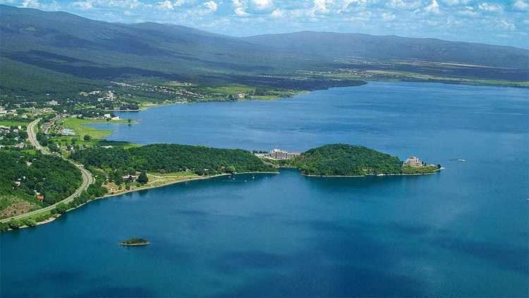
Zemplínska šírava (sometimes called the "Slovak sea" (Slovak: Slovenské more)). is a dam and lake in eastern Slovakia, near the town of Michalovce, wholly belonging to the Michalovce District. The name recalls the historical Zemplín region. The dam was built in 1961–1965, covers an area of 33 km2 (13 sq mi), has an average depth of 9.5 m (31 ft), with a maximum depth of 14 m (46 ft). Water from the dam flows into the Laborec river, which in turn flows into the Bodrog river. The area is primarily used for recreation. It also supplies cooling water for the Vojany Power Station.
Contents
- Zempl nska rava a k a dovolenka ako z katal gu
- Map of vodnC3A1 nC3A1drC5BE ZemplC3ADnska C5A0C3ADrava Slovakia
- Carp tour 2016 3 zempl nska rava
- References
Map of vodn%C3%A1 n%C3%A1dr%C5%BE Zempl%C3%ADnska %C5%A0%C3%ADrava, Slovakia
Carp tour 2016 3 zempl nska rava
References
Zemplínska šírava Wikipedia(Text) CC BY-SA