
Length 115 km (71.5 mi) Highest point Brusilov Ice Dome Area 2,821 km² | Highest elevation 416 m (1,365 ft) Elevation 416 m Island group Franz Josef Land | |
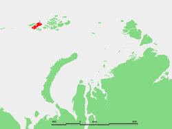 | ||
Zemlya Georga, or Prince George Land (Russian: Земля Георга; Zemlya Georga, "George Land"), is an island in Franz Josef Land, Arkhangelsk Oblast, Russian Arctic.
Contents
Map of Zemlya Georga, Arkhangelsk Oblast, Russia
Zemlya Georga was named by Benjamin Leigh Smith after Prince George.
Geography
With a total surface of 2,821 square kilometres (1,089 sq mi), Zemlya Georga is the largest island of the Franz Josef Archipelago. It is also the longest, with a distance of 115 kilometres (71 mi) between its northernmost and its southernmost ends. The highest point of the island is the summit of Brusilov Ice Dome, the northeastern ice dome, at 416 metres (1,365 ft).
The island has a complex coastline, with many bays, deep inlets and capes. Zemlya Georga has three capes pointing southwestwards on its southern coast: Cape Neale (the westernmost end of the island), Cape Crowther and Cape Grant. Its easternmost cape is known as Mys Murray. The two capes pointing north, Mys Bryusa and Mys Battenberg, are separated from each other by Sommerville Bay. The westernmost cape of this peninsula is Mys Mul'tanovskogo, beyond which lies the sound known as Proliv Arkhangelskiy between Zemlya Georga and Alexandra Land. The sound known as Cambridge Channel (Proliv Kambritch) is located further to the southwest.
The Nightingale Channel (Proliv Neytingeyl) runs east of Zemlya Georga, separating it from Bruce Island.
Glaciers
Most of the land lies under large glaciers and ice domes, such as the Brusilov Ice Dome, Gretton Ice Dome, Dzegudze Ice Dome (Купол Дзегудзе), Zander Ice Dome, Foggy Ice Dome (Купол туманный), Arctic Geology Research Institute Ice Dome (Купол Научно-исследовательский институт геологии Арктики) and the Peary Ice Dome, although there is a large, mostly unglacierized peninsula at its northern end, Poluostrov Armitidzh.