
Vehicle registration LA Elevation 767 m Population 3,299 (1 Apr 2009) Postal code 6511 | Time zone CET (UTC+1) Website www.zams.at Area 125 km² Local time Sunday 12:10 AM Area code 05442 | |
 | ||
Weather 10°C, Wind S at 3 km/h, 61% Humidity | ||
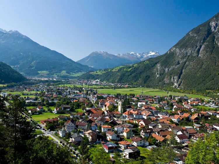
Zams is a municipality in the district of Landeck in the Austrian state of Tyrol.
Contents
- Map of 6511 Zams Austria
- Geography
- Local places
- Neighbour municipalities
- Personalities
- Economics
- References
Map of 6511 Zams, Austria
Geography
It is situated in a river basin together with its neighbour town Landeck near the rivers Inn and Sanna. The geographical location is 47°28′N 10°22′E. Here, the old roads coming from Vinschgau, Engadin, Bavaria and Lake Constance cross.
The free-standing church tower is a notable feature of the town. In 1911, a fire burned half the village to ash and destroyed much of the old man-made structures. The tower remained, and the church was established about fifty meters away.
Local places
Zams: Lötz, Rease, Oberdorf, Engere, Oberreit, Unterreit, Siedlung, Riefe
Zammerberg: Falterschein, Grist, Kronburg, Lahnbach, Rifenal, Schwaighof, Tatschhof, Anreit
Ausserfern: Madau
Neighbour municipalities
Bach, Austria, Fließ, Flirsch, Gramais, Grins, Imst, Kaisers, Landeck, Schönwies, Stanz bei Landeck, Strengen, Wenns
Personalities
Economics
While most other places in the Landeck district are shaped by tourism (especially winter tourism), in Zams handicraft, trade, and other services are major activities. About 5% of the population still practice agriculture, usually for supplementary income, particularly near Zammerberg.