
District Ústí nad Orlicí Elevation 412 m Population 93 (2006) | Postal code 565 54 Area 4.25 km² | |
 | ||
N m tov cvi en 2016 z dol
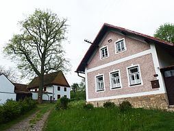
Zádolí is a village and municipality (obec) in the Ústí nad Orlicí District, Pardubice Region of the Czech Republic.
Contents
Map of 566 01 Z%C3%A1dol%C3%AD, Czechia
The municipality covers an area of 4.25 square kilometres (1.64 sq mi), and had a population of 93 (as of 3 July 2006).
Zádolí lies approximately 7 km southwest of Vysoke Myto, 22 km west of Ústí nad Orlicí, 29 km southeast of Pardubice, and 124 km east of Prague. The tiny village of Střihanov lies immediately to the east of Zádolí on Highway 367.
References
Zádolí Wikipedia(Text) CC BY-SA