
Website www.yayladagi.bel.tr Area 366 km² | Post code 31550 Elevation 613 m Local time Monday 12:59 PM | |
 | ||
Weather 15°C, Wind W at 8 km/h, 44% Humidity | ||
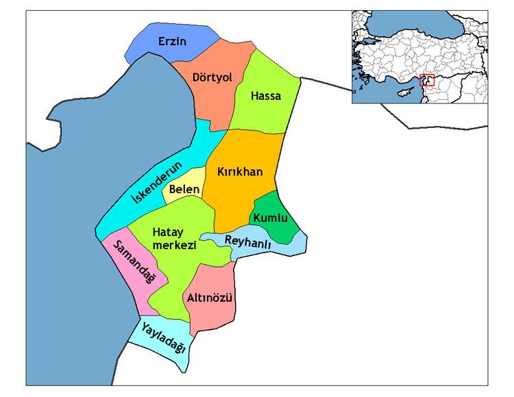
Yayladağı ([ˈjajɫaˈdaɰɯ], Arabic: اوردو) is a town and district of Hatay Province in southern Turkey, on the border between Turkey and Syria, 51 km (32 mi) south of the city of Antakya.
Contents
- Map of YayladaC49FC4B1 31550 YayladaC49FC4B12FHatay Turkey
- Demography
- History
- Geography
- Places of interest
- References
Map of Yaylada%C4%9F%C4%B1, 31550 Yaylada%C4%9F%C4%B1%2FHatay, Turkey
Demography
The population of Yayladağı is mostly composed from Sunni Turkmen population. After the Syrian civil war broke out, nearly 2,000 Syrian Turkmens were displaced from Turkmen Mount to here.
History
The district has a long history dating back to the Hittites. Islam was brought here by the Abbassid Arabs, and from 1075 onwards the Seljuk Turks. During the Crusades, the mountains were part of the principality of Antioch, then they returned to Muslim control, and in 1268 were brought into the Ottoman Empire by Sultan Selim I during his campaign into Egypt.
Geography
Today, Yayladağı itself is a small town of 5,717 people as of 2000 census, providing the district with a health centre, high schools and other basics.
This is a mountainous district with a typical Mediterranean climate of hot, dry summers and warm, wet winters, but being inland and high up, Yayladağı is cooler than most of Hatay, even seeing snow on the mountain peaks in winter. The main source of income is agriculture, 96 km2 (37 sq mi) of the land (small valleys and plateau in the mountains) is cultivated with olives, tobacco, vegetables, grains and other crops, the remainder is forest and mountain. The mountainsides are covered with pine, sandalwood and rough oak, or else shrubs including bay, thyme and oleander. Animals, especially goats, are grazed on the hillsides.
Yayladağı has a border crossing into Syria, and the village of Topraktutan, Turkey's southernmost point. The state road (European route ) connects the border checkpoint with Antakya.